The Kingston Russell stone circle 750m north east of Gorwell Farm
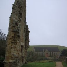
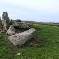
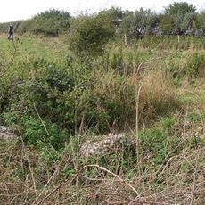
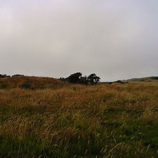
The Kingston Russell stone circle 750m north east of Gorwell Farm, Neolithic stone circle in Dorset, England
The Kingston Russell Stone Circle consists of eighteen fallen stones arranged in an oval formation measuring approximately 27 meters from north to south. The stones vary in size and rest on a chalk ridge positioned between two villages.
The site dates to the Late Neolithic or Early Bronze Age, roughly 4,000 years ago during Britain's period of megalithic construction. It was built during an era when similar stone circles were being raised across southern England.
The stones likely served as gathering places where early communities came together for ceremonies and important decisions affecting their groups. Today visitors can sense how these people used the space as a meeting point for shared purposes.
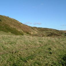
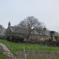
The monument sits at a crossroads where five walking paths meet on an exposed chalk ridge between two villages and can be reached via marked trails. The location allows visitors to explore the site on foot and connect it with other walking destinations.
This is the largest surviving stone circle in Dorset, with individual stones varying between approximately 2 meters and 1 meter in length. The variation in stone sizes shows that builders carefully selected which stones to use for the formation.
Location: Kingston Russell
Operator: English Heritage
Phone: +448703331181
Website: https://english-heritage.org.uk/visit/places/kingston-russell-stone-circle
GPS coordinates: 50.68850,-2.59899
Latest update: December 8, 2025 21:07
Abbotsbury Abbey
2.7 km
Abbotsbury Castle
2.5 km
Kingston Russell House
1.8 km
The Grey Mare and her Colts
976 m
Hampton Down Stone Circle
2.2 km
Parish Church of St Nicholas
2.6 km
Parish Church of St Michael and All Angels
1.6 km
St Luke'chapel
2 km
Ilchester Arms Hotel
2.5 km
The Old Post Office
2.5 km
The Abbey Dairy House
2.7 km
Littlebredy War Memorial
1.6 km
Bridehead
1.5 km
Stangways Hall
2.4 km
The Pynion End
2.7 km
Granary 40 Metres South Of The Abbey House
2.7 km
Abbey House
2.7 km
Gateway 25 Metres South-South-East Of Outer Gatehouse
2.7 km
1, Back Street
2.4 km
20 And 22, Rodden Row
2.5 km
16 And 18, Rodden Row
2.5 km
6 And 8, Rodden Row
2.5 km
3, Seaway Lane
2.7 km
2, Rodden Row
2.5 km
22, 24, 26, 28, Market Street
2.4 km
50, West Street
2.4 km
Two round barrows on Wears Hill
2.4 km
Abbott's Walk
2.7 kmVisited this place? Tap the stars to rate it and share your experience / photos with the community! Try now! You can cancel it anytime.
Discover hidden gems everywhere you go!
From secret cafés to breathtaking viewpoints, skip the crowded tourist spots and find places that match your style. Our app makes it easy with voice search, smart filtering, route optimization, and insider tips from travelers worldwide. Download now for the complete mobile experience.
A unique approach to discovering new places❞
— Le Figaro
All the places worth exploring❞
— France Info
A tailor-made excursion in just a few clicks❞
— 20 Minutes