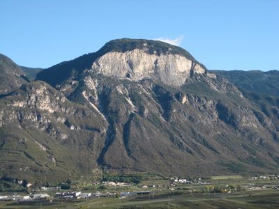
Madruttberg, Mountain summit in northern Italy.
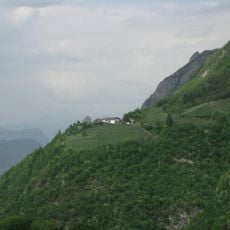
Madruttberg is a mountain summit in northern Italy standing at approximately 1,500 meters in elevation, marked by steep slopes and various hiking paths. The terrain features diverse topography with multiple marked routes accessible from different starting points throughout the region.
The mountain has served as a geographical landmark for inhabitants of the Fiemme valley region since early settlement patterns developed in the area. Its enduring presence shaped traditional land use and the routes that communities established for moving through the landscape.
The mountain serves as a gathering point for hikers from surrounding villages and holds a place in the traditions of communities living in the Fiemme valley. Knowledge of its routes and seasonal patterns passes informally between local residents who have grown up in these areas.
The mountain is accessible from several starting points with marked trails, and conditions are most favorable between June and September when weather is stable. Hikers should check with local information sources before setting out to confirm route conditions and current trail status.
From the top visitors can look in all directions and see both the distinctive peaks of the Dolomites and the limestone ridges of the Southern Limestone Alps. This complete surrounding view makes every visit a chance to observe several major mountain groups at once.
The community of curious travelers
AroundUs brings together thousands of curated places, local tips, and hidden gems, enriched daily by 60,000 contributors worldwide.