Roc du Mulinet, mountain in Italy
Elevation above the sea: 3,442 m
Website: http://ancien-geodesie.ign.fr/fiche_point.asp?num_site=7304710&no_ptg=01&numero_f50=3633
Website: http://ancien-geodesie.ign.fr/fiche_point.asp?num_site=7304710&no_ptg=01&numero_f50=3633
GPS coordinates: 45.38071,7.16273
Latest update: November 13, 2025 12:39
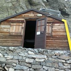
Bivacco Soardi - Fassero
3.9 km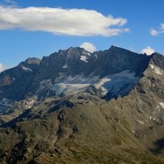
Levanna Centrale
3.4 km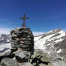
Levanna Orientale
3.1 km
Monte Barrouard
5 km
Albaron di Sea
5.1 km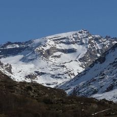
Levanna Occidentale
3.7 km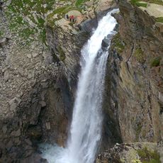
Cascade de la Reculaz
4.4 km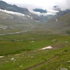
Évettes
4.5 km
Punta Girard
1.7 km
Cime Monfret
2.2 km
Glacier des Sources de l'Arc
2.2 km
Aiguille Percée
4.2 km
Ouille des Patriotes
4.1 km
Glacier du Mulinet
1.3 km
L'Uja
4.1 km
Cime Monfret
2.2 km
Glacier du Grand Méan
2.4 km
Lac Glaciaire du Grand Méan
3 km
Scenic viewpoint
4.3 km
Scenic viewpoint
3.5 km
Scenic viewpoint
4.9 km
Passo di napoleone
4.7 km
Cascate Colombin
3.6 km
Wayside cross
4.5 km
Waterfall
3.5 km
Waterfall
3.4 km
Waterfall
2.6 km
Cascate Colombin
3.6 kmReviews
Visited this place? Tap the stars to rate it and share your experience / photos with the community! Try now! You can cancel it anytime.
Discover hidden gems everywhere you go!
From secret cafés to breathtaking viewpoints, skip the crowded tourist spots and find places that match your style. Our app makes it easy with voice search, smart filtering, route optimization, and insider tips from travelers worldwide. Download now for the complete mobile experience.

A unique approach to discovering new places❞
— Le Figaro
All the places worth exploring❞
— France Info
A tailor-made excursion in just a few clicks❞
— 20 Minutes