Levanna Occidentale

Log in to your account

AroundUs is a community-driven map of interesting places, built by curious explorers like you. It grows with every review, story, and photo you share.
Connect to save your favorite spots, contribute locations, and create personalized routes.
Continue with Google
Continue with Apple
Continue with X
Continue with Facebook
Continue with email
By continuing, you accept our Terms and Conditions and our Privacy Policy
Create an account

Levanna Occidentale

Add to collection
Map
Suggest a change
Share

Levanna Occidentale, Mountain summit at the border of France and Italy

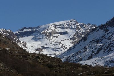
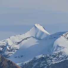
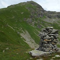
Levanna Occidentale is a mountain peak rising to 3,593 meters at the border between France and Italy, situated between two major Alpine protected areas. The summit features glaciers and rocky terrain, with climbing routes that pass through established mountain huts.

The mountain gained recognition as a climbing destination in the early 20th century during the expansion of Alpine tourism. Traditional routes developed through the era and remain the main access paths used by climbers today.

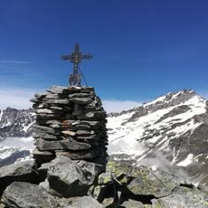
People on both sides of the border see this peak as a place where mountaineers test themselves against one of the Alps' tougher challenges. The mountain draws those who respect the difficulty and demands of high-altitude climbing.

This climb requires advanced technical skills, ice axes, and crampons due to glacier and steep rock sections on the route. Plan for roughly 10 hours of climbing from the starting point, so begin early and bring weather-appropriate gear.

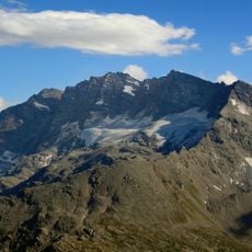
From the summit, three major Alpine ranges are visible: the Mont Blanc massif, the Vanoise mountains, and the Gran Paradiso peaks. This rare vista makes the location valuable for those wanting to see the scale of the eastern Alps from a single vantage point.

Location: Ceresole Reale

Location: Bonneval-sur-Arc

Elevation above the sea: 3,593 m

Part of: Levanna, France–Italy border, drainage divide between the Adriatic and Mediterranean seas

Website: http://geodesie.ign.fr/fiches/index.php?module=e&action=fichepdf&source=carte&sit_no=73047A

GPS coordinates: 45.41410,7.16209

Latest update: December 14, 2025 20:24

Photos
Reviews

Visited this place? Tap the stars to rate it and share your experience / photos with the community! Try now! You can cancel it anytime.

« Levanna Occidentale - Mountain summit at the border of France and Italy » is provided by Around Us (aroundus.com). Images and texts are derived from Wikimedia project under a Creative Commons license. You are allowed to copy, distribute, and modify copies of this page, under the conditions set by the license, as long as this note is clearly visible.

Discover hidden gems everywhere you go!

From secret cafés to breathtaking viewpoints, skip the crowded tourist spots and find places that match your style. Our app makes it easy with voice search, smart filtering, route optimization, and insider tips from travelers worldwide. Download now for the complete mobile experience.

Around Us App Screenshot

A unique approach to discovering new places

Le Figaro

All the places worth exploring

France Info

A tailor-made excursion in just a few clicks

20 Minutes