Enable Location

We need your location to show you interesting places around you

Discover nearby places

Find interesting locations and hidden gems around you

Precise directions

Get accurate directions and distances to places

Your location is never shared with other users. It's only used when you tap the location button.

Log in to your account

Start exploring — it's free

Trusted by 63,118 travelers worldwide

Continue with Google
Continue with Apple
or

We will send you a code to connect

By continuing, you accept our Terms and Conditions and our Privacy Policy

Check your inbox

We've sent a pincode in your inbox. Please enter the code below.

黒又山
Discussion Reviews Photo
11.5k Popularity

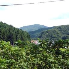
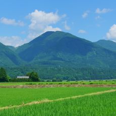
黒又山, Mountain summit in Kazuno, Japan.

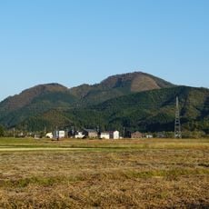
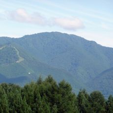
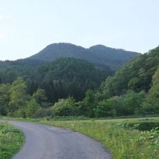
Kuromata Mountain rises 280.6 meters above sea level with a distinctive conical shape in Kazuno City's Daiyu district. A hiking trail begins at the torii gate of Hongu Shrine and passes through dense forest on the way to the summit.

The mountain was inhabited during the Jomon period, as shown by finds at multiple sites around its base. Researchers uncovered stone tools and pottery in the early 1990s that demonstrate long-term use of the area.

The Hongu Shrine at the summit holds religious meaning for local communities who visit to pay respects. The shrine represents a connection between the mountain and spiritual traditions that have roots in the region.

The trail is accessible but requires some physical preparation due to the elevation gain. Visitors should bring proper footwear and water, as the forest canopy offers limited shade along the route.

Multiple archaeological sites around the mountain date back to the Jomon period and document early human activity in the region. These discoveries show that this location held importance in human settlement patterns across millennia.

The community of curious travelers

AroundUs brings together thousands of curated places, local tips, and hidden gems, enriched daily by 60,000 contributors worldwide.

Start exploring
Elevation above the sea
280.6 m
GPS coordinates
40.28374,140.82154
Latest update
December 8, 2025 13:40
Reviews
Share your experience

No review yet

Discussions
Start a discussion...

No discussion yet

« 黒又山 - Mountain summit in Kazuno, Japan » is provided by Around Us (aroundus.com). Images and texts are derived from Wikimedia project under a Creative Commons license. You are allowed to copy, distribute, and modify copies of this page, under the conditions set by the license, as long as this note is clearly visible.

Discover hidden gems everywhere you go!

From secret cafés to breathtaking viewpoints, skip the crowded tourist spots and find places that match your style. Our app makes it easy with voice search, smart filtering, route optimization, and insider tips from travelers worldwide. Download now for the complete mobile experience.

Around Us App Screenshot

A unique approach to discovering new places

Le Figaro

All the places worth exploring

France Info

A tailor-made excursion in just a few clicks

20 Minutes

Around Us
Travel Guide & Maps
Download

Send to your phone

QR Code
1

Open the camera app on your mobile.

2

Point at the QR code with your camera. A notification will appear.

3

Tap the notification to open the link.