Mount Ōgigata, mountain in Kurotaki and Tenkawa, Nara prefecture, Japan
Location: Nara Prefecture
Location: Kurotaki
Location: Tenkawa
Elevation above the sea: 1,053 m
Part of: Nara 100 Mountains
GPS coordinates: 34.28229,135.85276
Latest update: November 14, 2025 05:29

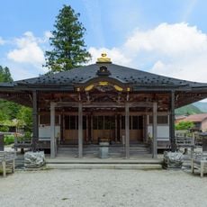
Ryūsen-ji
2.8 km
Hōkaku-ji
5.6 km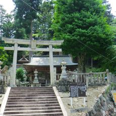
Kawawake Shrine
2.8 km
Karigane Bridge
2.9 km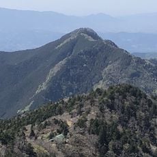
Mount Ōtenjō
5.7 km
大峰サラダ遥拝所
5.8 km
御手洗渓谷
5.7 km
蟷螂の窟
3.9 km
蝙蝠の窟
3.8 km
光遍寺
5.4 km
後村上天皇の子孫
5.4 km
駐車場
5.7 km
旧 白飯寺
6.6 km
黒木御所跡
6.6 km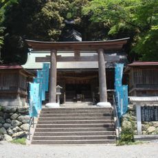
Niukawakami Shrine Shimosha
5.3 km
吊り橋
5.7 km
面不動鍾乳洞
2.7 km
Scenic viewpoint
3 km
Scenic viewpoint
4.9 km
Scenic viewpoint
5.3 km
面不動鍾乳洞
2.7 km
西行庵
6.7 km
人為玉霊峰碑
7.2 km
分岐石碑
7.1 km
貝初延命地蔵
3.9 km
天川村出身戦没者慰霊銘碑
4.5 km
Christianity, Catholic church building, wayside shrine
4.7 km
かじかの滝
4.5 kmReviews
Visited this place? Tap the stars to rate it and share your experience / photos with the community! Try now! You can cancel it anytime.
Discover hidden gems everywhere you go!
From secret cafés to breathtaking viewpoints, skip the crowded tourist spots and find places that match your style. Our app makes it easy with voice search, smart filtering, route optimization, and insider tips from travelers worldwide. Download now for the complete mobile experience.

A unique approach to discovering new places❞
— Le Figaro
All the places worth exploring❞
— France Info
A tailor-made excursion in just a few clicks❞
— 20 Minutes