Enable Location

We need your location to show you interesting places around you

Discover nearby places

Find interesting locations and hidden gems around you

Precise directions

Get accurate directions and distances to places

Your location is never shared with other users. It's only used when you tap the location button.

Log in to your account

Start exploring — it's free

Trusted by 61,868 travelers worldwide

Continue with Google
Continue with Apple
or

We will send you a code to connect

By continuing, you accept our Terms and Conditions and our Privacy Policy

Check your inbox

We've sent a pincode in your inbox. Please enter the code below.

Wijkermeerpolder

Wijkermeerpolder, Reclaimed polder between Beverwijk and Assendelft, Netherlands

Description

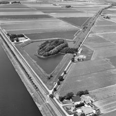
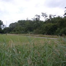
Wijkermeerpolder is a reclaimed polder between Beverwijk and Assendelft in the Netherlands, consisting of flat farmland with regular canals and field roads. The area is bounded by dikes and earthen walls that manage water levels and protect the agricultural land.

History

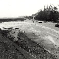
The polder was created in 1873 when the Wijkermeer lake was drained as part of the North Sea Canal construction project. This drainage transformed the former water body into productive agricultural land and shaped the region's infrastructure and economy.

Culture

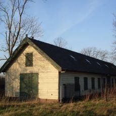
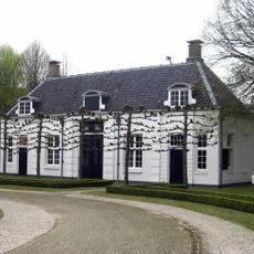
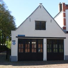
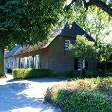
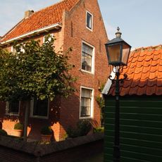
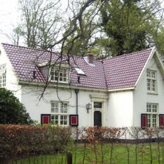
The polder remains a center of agricultural tradition, where fields and working farms shape the landscape and reflect the rural way of life that continues across the region. The scattered farm buildings and the rhythm of seasonal farming give the area its distinct rural character.

Practical

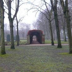
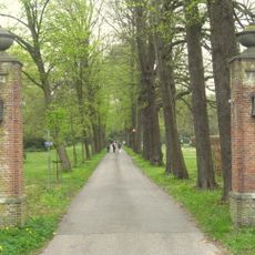
The polder is crossed by a network of dikes and roads accessible to walkers and cyclists, making it suitable for casual walking and cycling tours. The flat terrain makes it easy to navigate and allows visitors to observe the farming and water management systems at ground level.

Did you know?

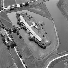
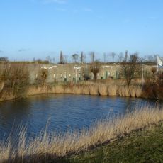
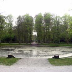
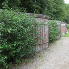
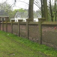
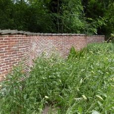
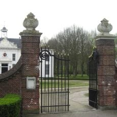
Fort Zuidwijkermeer sits in the southwestern section and was built as part of the Amsterdam Defense Line to protect against invasion. This historic fortification remains a quiet reminder of 19th-century military strategy hidden within the flat landscape.

Location
Location
Part of
IJpolders
GPS coordinates
52.46255,4.68018
Latest update
December 18, 2025 11:40

AroundUs brings together thousands of curated places, local tips, and hidden gems, enriched daily by 60,000 contributors worldwide. Discover all places nearby (Beverwijk).

Around this place
Fort aan de St. Aagtendijk
Netherlands

Fort aan de St. Aagtendijk

1.7 km
Fort Velsen
Netherlands

Fort Velsen

917 m
Fort Zuidwijkermeer
Netherlands

Fort Zuidwijkermeer

877 m
Liniewal Aagtendijk–Zuidwijkermeer
Netherlands

Liniewal Aagtendijk–Zuidwijkermeer

212 m
Velserdijk
Netherlands

Velserdijk

1.9 km
Beeckestijn main building
Netherlands

Beeckestijn main building

2.2 km
Climbing wall and viewpoint Spaarnwoude
Netherlands

Climbing wall and viewpoint Spaarnwoude

1.6 km
Beeckestijn carriage houses
Netherlands

Beeckestijn carriage houses

2.2 km
Beeckestijn, park- en tuinaanleg
Netherlands

Beeckestijn, park- en tuinaanleg

2.2 km
Schuur van belang ter afsluiting van het kerkplein
Netherlands

Schuur van belang ter afsluiting van het kerkplein

2.2 km
Boerderij, gepleisterde lage woning in topgevels eindigend, laag hek
Netherlands

Boerderij, gepleisterde lage woning in topgevels eindigend, laag hek

2.2 km
Serpentine wall Beeckestijn
Netherlands

Serpentine wall Beeckestijn

2.2 km
Terrein waarin de resten van een fort met haven uit de Romeinse tijd
Netherlands

Terrein waarin de resten van een fort met haven uit de Romeinse tijd

1.5 km
Beeckestijn, tuinmuur met speelhuisjes
Netherlands

Beeckestijn, tuinmuur met speelhuisjes

2.2 km
Zuiderdorpstraat 4, Velsen-Zuid
Netherlands

Zuiderdorpstraat 4, Velsen-Zuid

2.2 km
Beeckestijn, slangemuur nabij het linker koetshuis
Netherlands

Beeckestijn, slangemuur nabij het linker koetshuis

2.2 km
Beeckestijn, toegangshek naar het plein voor het hoofdgebouw
Netherlands

Beeckestijn, toegangshek naar het plein voor het hoofdgebouw

2.2 km
Beeckestijn, paar hekpijlers nabij de gereconstrueerde rozentuin
Netherlands

Beeckestijn, paar hekpijlers nabij de gereconstrueerde rozentuin

2.2 km
Waterland, portierswoning
Netherlands

Waterland, portierswoning

2.2 km
Waterland, toegangshek
Netherlands

Waterland, toegangshek

2.1 km
Zuiderdorpstraat 7, Velsen-Zuid
Netherlands

Zuiderdorpstraat 7, Velsen-Zuid

2.2 km
Ventilation towers Velsertunnel
Netherlands

Ventilation towers Velsertunnel

1.8 km
Pand met gepleisterde topgevel
Netherlands

Pand met gepleisterde topgevel

2.2 km
Meervlietstraat 58, Velsen-Zuid
Netherlands

Meervlietstraat 58, Velsen-Zuid

2.2 km
Meervlietstraat 34, Velsen-Zuid
Netherlands

Meervlietstraat 34, Velsen-Zuid

2.2 km
De Ark
Netherlands

De Ark

2.2 km
Kerkesingel 5, Velsen-Zuid
Netherlands

Kerkesingel 5, Velsen-Zuid

2.2 km
Pand met gepleisterde topgevel
Netherlands

Pand met gepleisterde topgevel

2.2 km
Show the full map
« Wijkermeerpolder - Reclaimed polder between Beverwijk and Assendelft, Netherlands » is provided by Around Us (aroundus.com). Images and texts are derived from Wikimedia project under a Creative Commons license. You are allowed to copy, distribute, and modify copies of this page, under the conditions set by the license, as long as this note is clearly visible.

Discover hidden gems everywhere you go!

From secret cafés to breathtaking viewpoints, skip the crowded tourist spots and find places that match your style. Our app makes it easy with voice search, smart filtering, route optimization, and insider tips from travelers worldwide. Download now for the complete mobile experience.

Around Us App Screenshot

A unique approach to discovering new places

Le Figaro

All the places worth exploring

France Info

A tailor-made excursion in just a few clicks

20 Minutes

Around Us
Travel Guide & Maps
Download

Send to your phone

QR Code
1

Open the camera app on your mobile.

2

Point at the QR code with your camera. A notification will appear.

3

Tap the notification to open the link.