Enable Location

We need your location to show you interesting places around you

Discover nearby places

Find interesting locations and hidden gems around you

Precise directions

Get accurate directions and distances to places

Your location is never shared with other users. It's only used when you tap the location button.

Fort Ronduit

Log in to your account

Save your favorite places
Create custom travel routes
Rate and review places
Access the full interactive map
Continue with Google
Continue with Apple
Continue with email
By continuing, you accept our Terms and Conditions and our Privacy Policy
Create an account
Add to collection
Map
Suggest a change
Share

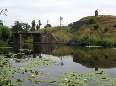
Fort Ronduit, Military fort in Naarden, Netherlands.

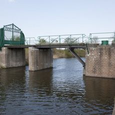
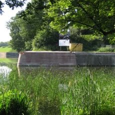
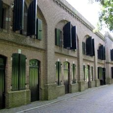
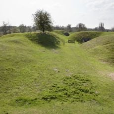
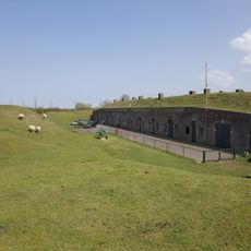
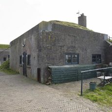
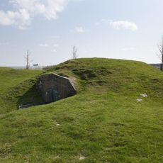
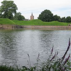
Fort Ronduit is a military fortification in Naarden featuring three bombproof structures: a guardhouse, barracks, and storage building, connected by a network of defensive waterways and earthen embankments. The layout positions these buildings around engineered canals designed for defense.

The fort was built between 1873 and 1875 as part of the New Dutch Waterline, strengthening northern defenses around Naarden. It was constructed during a period when the Netherlands was modernizing its defensive systems.

This complex demonstrates how the Dutch approached military defense by combining architecture with water management as a protective system. The fort shows the importance placed on defending the Naarden region during the 19th century.

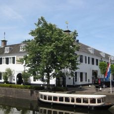
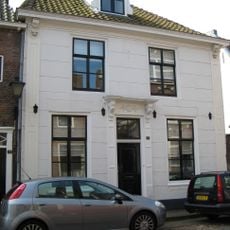
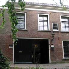
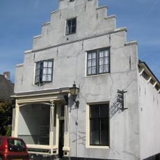
The fort is not open to regular visitors as it is currently rented out, but the exterior can be viewed from nearby walking paths in the area. You can still appreciate the fortification's design and layout from the surrounding paths.

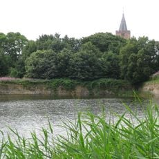
The fort employed a canal system that could flood surrounding areas, creating a water-based barrier that made the terrain impassable for invaders. This water-based defense strategy was a signature Dutch approach to military protection.

Location: Gooise Meren

Inception: 1875

Part of: New Dutch Waterline, Dutch Water Line

Address: Fort Ronduit met brug

GPS coordinates: 52.30274,5.16476

Latest update: December 14, 2025 14:45

Photos
Reviews

Visited this place? Tap the stars to rate it and share your experience / photos with the community! Try now! You can cancel it anytime.

« Fort Ronduit - Military fort in Naarden, Netherlands » is provided by Around Us (aroundus.com). Images and texts are derived from Wikimedia project under a Creative Commons license. You are allowed to copy, distribute, and modify copies of this page, under the conditions set by the license, as long as this note is clearly visible.

Discover hidden gems everywhere you go!

From secret cafés to breathtaking viewpoints, skip the crowded tourist spots and find places that match your style. Our app makes it easy with voice search, smart filtering, route optimization, and insider tips from travelers worldwide. Download now for the complete mobile experience.

Around Us App Screenshot

A unique approach to discovering new places

Le Figaro

All the places worth exploring

France Info

A tailor-made excursion in just a few clicks

20 Minutes