Kjerringstupet, cliff in Sør-Varanger municipality, Norway
Location: Sør-Varanger Municipality
GPS coordinates: 69.71685,30.07861
Latest update: November 6, 2024 10:15
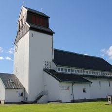
Kirkenes Church
1.8 km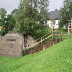
Andersgrotta
1.6 km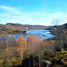
Bøkfjorden
3.1 km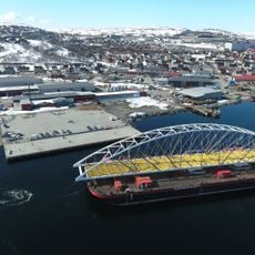
Bøkfjord Bridge
4.1 km
Varanger museum
1.5 km
Saviomuseet
1.3 km
Sør-Varanger museum
1.4 km
Varanger Museum, avd. Sør-Varanger
1.3 km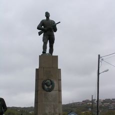
Russermonumentet
1.7 km
Fugleberget
2.9 km
Melkberget
3 km
Slettberget
3.9 km
Ramleberget
1.9 km
Reinberget
2 km
Sydvaranger AS - Lokstallen - Lokomotivstallen
1.7 km
Umatrikulert statsgrunn v/Trifanbekken
2.3 km
Sydvaranger gamle kirkegård
1.9 km
Helse Finnmark Kirkenes
1.3 km
Scenic viewpoint
1.3 km
Scenic viewpoint
1.3 km
Påleparken
2.1 km
Samovarteateret
1.1 km
Småflogan
2.3 km
Scenic viewpoint
1.1 km
Scenic viewpoint
909 m
Prestefjellet
793 m
Storflogan
3.1 km
Scenic viewpoint
413 mReviews
Visited this place? Tap the stars to rate it and share your experience / photos with the community! Try now! You can cancel it anytime.
Discover hidden gems everywhere you go!
From secret cafés to breathtaking viewpoints, skip the crowded tourist spots and find places that match your style. Our app makes it easy with voice search, smart filtering, route optimization, and insider tips from travelers worldwide. Download now for the complete mobile experience.

A unique approach to discovering new places❞
— Le Figaro
All the places worth exploring❞
— France Info
A tailor-made excursion in just a few clicks❞
— 20 Minutes