
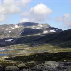
Seter
Location: Ullensvang Municipality
GPS coordinates: 59.98979,7.20553
Latest update: November 15, 2025 17:24
Sandfloegga
5.7 km
Vilurenuten
6.3 km
Sandflofossen
8.1 km
Middalstoppen
7.1 km
Simletind (tumoy sa bukid)
3.4 km
Brokafossen
10.6 km
Bjørnanutane
9.5 km
Sandviknuten
3.1 km
Buanuten
1.9 km
Nibbo
10.4 km
Urdanuten
9.6 km
Eltaren
7.4 km
Store Nupsfonn
9.7 km
Veslekoll
9.7 km
Veidemannbu
3.1 km
Prestkono
9.1 km
Kvannenutane
7.9 km
Hellevassbu turisthytte
924 m
Eltarnuten
7.5 km
Belebotn
7.6 km
Øverlandhytta
9.2 km
Hedlevatn
1.5 km
Eriksbu Politihytta
2.9 km
Drykkjesteinen bu
8.9 km
Frøysteinsnaustet
10.7 km
ArtHeart
10.4 km
Waterfall
332 m
Waterfall
10.1 kmReviews
Visited this place? Tap the stars to rate it and share your experience / photos with the community! Try now! You can cancel it anytime.
Discover hidden gems everywhere you go!
From secret cafés to breathtaking viewpoints, skip the crowded tourist spots and find places that match your style. Our app makes it easy with voice search, smart filtering, route optimization, and insider tips from travelers worldwide. Download now for the complete mobile experience.

A unique approach to discovering new places❞
— Le Figaro
All the places worth exploring❞
— France Info
A tailor-made excursion in just a few clicks❞
— 20 Minutes