Länghem 232:1, hällristning i Västergötland
Location: Tranemo Municipality
GPS coordinates: 57.63619,13.29580
Latest update: November 20, 2025 14:54
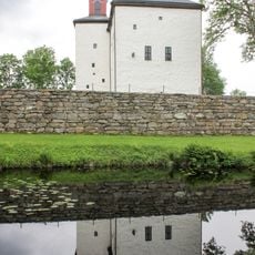
Torpa stenhus
1.8 km
Torpanäset
602 m
Hofsnäs
717 m
Länghem 33:1
2.1 km
Länghem 15:1
2 km
Länghem 248:1
2 km
Länghem 18:3
1.9 km
Länghem 26:2
2.1 km
Länghem 240:1
2 km
Länghem 26:3
2.1 km
Länghem 10:1
2 km
Länghem 18:2
1.9 km
Länghem 35:1
1.6 km
Länghem 8:1
1.6 km
Länghem 16:1
2.2 km
Länghem 18:1
1.9 km
Länghem 26:1
2.2 km
Länghem 34:1
2.1 km
Länghem 18:4
1.9 km
Länghem 35:2
1.6 km
Länghem 230:1
1.2 km
Länghem 32:1
2.1 km
Länghem 231:1
1.1 km
Länghem 232:2
2 m
Länghem 238:1
1.2 km
Länghem 238:3
1.2 km
Länghem 13:1
2.2 km
Länghem 9:1
1.6 kmReviews
Visited this place? Tap the stars to rate it and share your experience / photos with the community! Try now! You can cancel it anytime.
Discover hidden gems everywhere you go!
From secret cafés to breathtaking viewpoints, skip the crowded tourist spots and find places that match your style. Our app makes it easy with voice search, smart filtering, route optimization, and insider tips from travelers worldwide. Download now for the complete mobile experience.

A unique approach to discovering new places❞
— Le Figaro
All the places worth exploring❞
— France Info
A tailor-made excursion in just a few clicks❞
— 20 Minutes