Töftedal 19:1, stone setting in Dals-Ed Municipality, Älvsborg County, Sweden
Location: Dals-Ed Municipality
GPS coordinates: 58.81278,11.80791
Latest update: November 22, 2025 20:37
Gesäters kyrka
3.4 km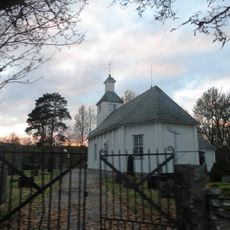
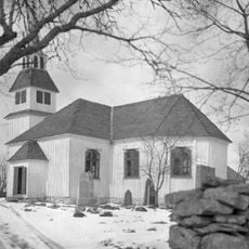
Töftedals kyrka
3.9 km
Töftedal 22:2
2.6 km
Töftedal 18:1
608 m
Gesäter 13:1
3 km
Töftedal 141:2
2.5 km
Töftedal 141:3
2.5 km
Ringesten
1.2 km
Gesäter 19:1
3.7 km
Töftedal 22:4
2.5 km
Rölanda 44:1
2.6 km
Töftedal 17:1
646 m
Töftedal 20:1
2.8 km
Töftedal 18:2
591 m
Gesäter 15:1
3.7 km
Töftedal 78:1
2.5 km
Krokstad 7:1
3.2 km
Töftedal 22:1
2.6 km
Töftedal 214
3.4 km
Töftedal 22:3
2.6 km
Gesäter 2:1
3.5 km
Töftedal 23:1
2.6 km
Gesäter 10:1
3.3 km
Krokstad 8:1
3.6 km
Gesäter 14:1
3.3 km
Töftedal 63:1
2.6 km
Töftedal 142:1
2.5 km
Gesäter 34:1
3.6 kmReviews
Visited this place? Tap the stars to rate it and share your experience / photos with the community! Try now! You can cancel it anytime.
Discover hidden gems everywhere you go!
From secret cafés to breathtaking viewpoints, skip the crowded tourist spots and find places that match your style. Our app makes it easy with voice search, smart filtering, route optimization, and insider tips from travelers worldwide. Download now for the complete mobile experience.

A unique approach to discovering new places❞
— Le Figaro
All the places worth exploring❞
— France Info
A tailor-made excursion in just a few clicks❞
— 20 Minutes