Töftedal 20:1, Hügelgrab in Schweden
Location: Dals-Ed Municipality
GPS coordinates: 58.83642,11.79372
Latest update: June 15, 2024 11:54
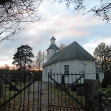
Töftedals kyrka
1.1 km
Töftedal 185
4.1 km
Töftedal 18:1
2.7 km
Töftedal 237
3.4 km
Töftedal 22:2
671 m
Töftedal 19:1
2.8 km
Töftedal 230
4.1 km
Töftedal 32:1
3.1 km
Ringesten
3.6 km
Töftedal 92:1
4.2 km
Rölanda 44:1
2.9 km
Töftedal 141:3
1.8 km
Töftedal 141:2
1.8 km
Töftedal 17:1
2.8 km
Töftedal 22:4
706 m
Töftedal 18:2
2.7 km
Töftedal 249
4 km
Töftedal 214
2.3 km
Töftedal 22:3
674 m
Töftedal 74:1
3.1 km
Töftedal 22:1
649 m
Töftedal 23:1
563 m
Töftedal 78:1
282 m
Töftedal 63:1
1.8 km
Töftedal 42:1
3 km
Töftedal 142:1
1.6 km
Töftedal 180:1
3.8 km
Töftedal 21:1
1.3 kmReviews
Visited this place? Tap the stars to rate it and share your experience / photos with the community! Try now! You can cancel it anytime.
Discover hidden gems everywhere you go!
From secret cafés to breathtaking viewpoints, skip the crowded tourist spots and find places that match your style. Our app makes it easy with voice search, smart filtering, route optimization, and insider tips from travelers worldwide. Download now for the complete mobile experience.

A unique approach to discovering new places❞
— Le Figaro
All the places worth exploring❞
— France Info
A tailor-made excursion in just a few clicks❞
— 20 Minutes