Stenkyrka 49:1, röse i Bohuslän
Location: Tjörn Municipality
GPS coordinates: 57.95652,11.56040
Latest update: November 17, 2025 16:29
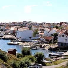
Klädesholmen
1.9 km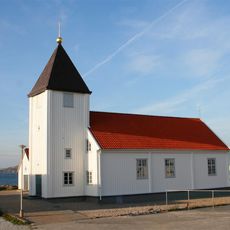
Klädesholmens kyrka
1.5 km
Tuveslätt
2.2 km
Stenkyrka 88:1
400 m
Stenkyrka 253:1
2 km
Stenkyrka 93:1
2.4 km
Ängholmen lower light
1.3 km
Ängholmen upper light
1.4 km
Stenkyrka 92:1
2.1 km
Stenkyrka 85:2
1.4 km
Stenkyrka 528:1
211 m
Stenkyrka 91:1
2.2 km
Stenkyrka 252:1
1.8 km
Stenkyrka 99:1
687 m
Stenkyrka 85:1
1.4 km
Stenkyrka 251:1
1.4 km
Stenkyrka 78:1
1.4 km
Stenkyrka 76:1
1 km
Stenkyrka 75:1
2.2 km
Stenkyrka 77:1
1.6 km
Stenkyrka 87:1
1.2 km
Stenkyrka 70:2
2.5 km
Klädesholmens museum "Sillebua"
1.6 km
Stenkyrka 86:1
768 m
Stenkyrka 529:3
199 m
Stenkyrka 50:1
229 m
Work of art
2 km
Scenic viewpoint
1.7 kmReviews
Visited this place? Tap the stars to rate it and share your experience / photos with the community! Try now! You can cancel it anytime.
Discover hidden gems everywhere you go!
From secret cafés to breathtaking viewpoints, skip the crowded tourist spots and find places that match your style. Our app makes it easy with voice search, smart filtering, route optimization, and insider tips from travelers worldwide. Download now for the complete mobile experience.

A unique approach to discovering new places❞
— Le Figaro
All the places worth exploring❞
— France Info
A tailor-made excursion in just a few clicks❞
— 20 Minutes