Mangskog 118:1, kvarn i Värmland
Location: Arvika Municipality
GPS coordinates: 59.83023,12.77197
Latest update: November 20, 2025 03:32
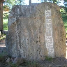
Skramlestenen
11.2 km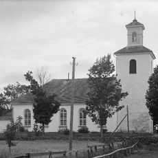
Mangskog Church
9.3 km
Byamossarna
8.6 km
Tiskaretjärn (Atikullen)
9.8 km
Perserud
11.1 km
Örvattnet
10.8 km
Kalvhöjden
9.3 km
Mangskog 5:1
10.1 km
Mangskog 262:1
4.8 km
Raggkvarn el. Ragga
7.1 km
Mangskogs hembygdsgård
8.7 km
Gräsmark 294:1
5.6 km
Gräsmark 23:1
10 km
Finntorpet
10.9 km
Mangskog 212:3
2.1 km
Yxforsen
9.5 km
Gräsmark 24:1
9.9 km
Öster Kvarn
8.4 km
Mangskog 188:1
6.7 km
Mangskog
1.8 km
Gräsmark 311:4
4.5 km
Gräsmark 22:1
9.9 km
Offerhall
11 km
Gräsmark 70:1
10 km
Gräsmark 59:1
10.7 km
Mangskog 261:1
1.2 km
Mangskog 301:1
6.4 km
Scenic viewpoint
5.1 kmReviews
Visited this place? Tap the stars to rate it and share your experience / photos with the community! Try now! You can cancel it anytime.
Discover hidden gems everywhere you go!
From secret cafés to breathtaking viewpoints, skip the crowded tourist spots and find places that match your style. Our app makes it easy with voice search, smart filtering, route optimization, and insider tips from travelers worldwide. Download now for the complete mobile experience.

A unique approach to discovering new places❞
— Le Figaro
All the places worth exploring❞
— France Info
A tailor-made excursion in just a few clicks❞
— 20 Minutes