Asker 20:1, röse i Närke
Location: Örebro Municipality
GPS coordinates: 58.99545,15.59731
Latest update: November 6, 2025 22:10
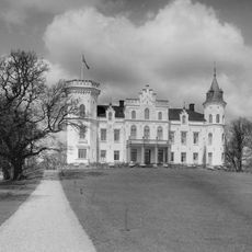
Boo Castle
9 km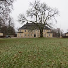
Bystad Manor
8.1 km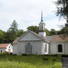
Bo Church
9 km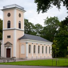
Brevens kyrka
2 km
Högsjö Church
5.2 km
Brevens tallskogar
3.6 km
Brevens tallskogar
2 km
Sotterns Skärgårds naturreseervat
8.8 km
Tomsängen
7.8 km
Brevens Bruk museum
2.2 km
Bo 19:2
9.5 km
Asker 34:1
1.1 km
Solberga, public beach
6.9 km
Asker 22:1
6.9 km
Röda Sand, public beach
2.4 km
Mene
9.4 km
Lännäs 47:1
6.7 km
Asker 16:1
3 km
Asker 16:2
3 km
Asker 16:3
3 km
Ålö
9.2 km
Regna 129:1
9.5 km
Asker 3:1
4.4 km
Högsjö bruksmuseum
5.4 km
Västra Vingåker 42:1
7.6 km
Västra Vingåker 38:1
7.1 km
Långa udden
4.6 km
Hunnebergsfallet
2.4 kmReviews
Visited this place? Tap the stars to rate it and share your experience / photos with the community! Try now! You can cancel it anytime.
Discover hidden gems everywhere you go!
From secret cafés to breathtaking viewpoints, skip the crowded tourist spots and find places that match your style. Our app makes it easy with voice search, smart filtering, route optimization, and insider tips from travelers worldwide. Download now for the complete mobile experience.

A unique approach to discovering new places❞
— Le Figaro
All the places worth exploring❞
— France Info
A tailor-made excursion in just a few clicks❞
— 20 Minutes