Batteribacken, stridsvärn i Ångermanland (Björna 278:1)
Location: Örnsköldsvik Municipality
GPS coordinates: 63.54010,18.61898
Latest update: November 21, 2025 23:23

Kålhuvudet
14.4 km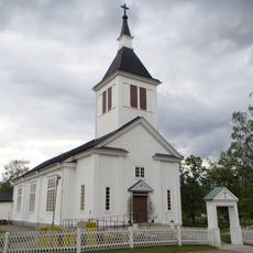
Björna Church
4.2 km
Getingstaliden
5.4 km
Kravattsliden
9.3 km
Gottne fäbodar
13 km
Björnsjö station
8.6 km
Gammbodarna
9.8 km
Museiföreningen Örnsköldsviks Järnvägssällskap
8.6 km
Arnäs 177:1
10.8 km
Gamm-västerhusbodarna
12.4 km
Västerhus-Nybodarna
12 km
Djupsjöbodarna
11.3 km
Kyrksten
8.2 km
Björnabodarna
10.8 km
Östansjö gamla fäbodar
12.9 km
Gammfäbodvallen
12.8 km
Gammbodvallen
12.6 km
Gammfäboden
6.3 km
Västergissjöbodarna
11.9 km
Långstrandsforsen
10.6 km
Långvattnet samfällighet vattensåg
13.6 km
Batteribacken
158 m
Svedjefäbodarna
7.8 km
Gruvberget
7.5 km
Östansjöbodarna
13.1 km
Gideberget
1.5 km
Kravattensliden
9.3 km
Kammen
10.5 kmReviews
Visited this place? Tap the stars to rate it and share your experience / photos with the community! Try now! You can cancel it anytime.
Discover hidden gems everywhere you go!
From secret cafés to breathtaking viewpoints, skip the crowded tourist spots and find places that match your style. Our app makes it easy with voice search, smart filtering, route optimization, and insider tips from travelers worldwide. Download now for the complete mobile experience.

A unique approach to discovering new places❞
— Le Figaro
All the places worth exploring❞
— France Info
A tailor-made excursion in just a few clicks❞
— 20 Minutes