Nordingrå 54:1, röse i Ångermanland
Location: Kramfors Municipality
GPS coordinates: 62.96068,18.53916
Latest update: November 22, 2025 17:47

Norrfällsviken
538 m
Storsand
3.3 km
Rammberget
1.5 km
Nordingrå 50:1
815 m
Ytternäsan
926 m
Nordingrå 78:1
3 km
Nordingrå 51:7
887 m
Nordingrå 51:8
894 m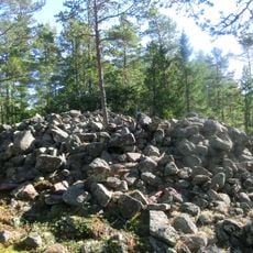
Nordingrå 30:1
1.2 km
Nordingrå 31:1
1.1 km
Nordingrå 53:2
558 m
Nordingrå 31:2
1.1 km
Nordingrå 52:2
494 m
Nordingrå 50:2
824 m
Nordingrå 30:2
1.3 km
Nordingrå 51:5
887 m
Nordingrå 52:1
509 m
Nordingrå 51:1
893 m
Nordingrå 53:1
551 m
Nordingrå 51:6
886 m
Nordingrå 53:3
572 m
Nordingrå 55:1
571 m
Nordingrå 77:1
3.4 km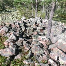
Nordingrå 32:1
969 m
Nordingrå 78:2
3 km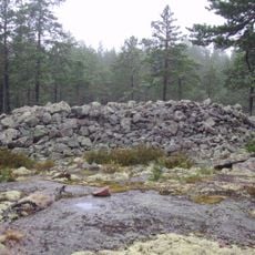
Jättenhusrösan
2.6 km
Storsanden
3.2 km
Scenic viewpoint
347 mReviews
Visited this place? Tap the stars to rate it and share your experience / photos with the community! Try now! You can cancel it anytime.
Discover hidden gems everywhere you go!
From secret cafés to breathtaking viewpoints, skip the crowded tourist spots and find places that match your style. Our app makes it easy with voice search, smart filtering, route optimization, and insider tips from travelers worldwide. Download now for the complete mobile experience.

A unique approach to discovering new places❞
— Le Figaro
All the places worth exploring❞
— France Info
A tailor-made excursion in just a few clicks❞
— 20 Minutes