Jäder 84:3, bildristning i Södermanland
Location: Eskilstuna Municipality
GPS coordinates: 59.40962,16.69050
Latest update: June 15, 2024 10:17
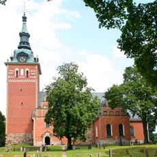
Jäder Church
30 m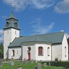
Kjula Church
1.7 km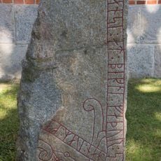
Runenstein Sö 96
49 m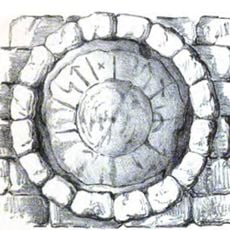
Runestone Sö 98
23 m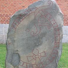
Runenstein Sö 97
46 m
Jäder 72:1
1.5 km
Jäder 83:1
381 m
Jäder 71:1
1.5 km
Sö Fv1969;298
1.7 km
Kjula 18:1
1.5 km
Jäder 170
690 m
Fässlinge skans
703 m
Jäder 163:2
1.5 km
Kjula 15:1
1.8 km
Jäder 66:1
1.6 km
Jäder 69:2
661 m
Jäder 56:1
891 m
Jäder 69:1
637 m
Kjula 14:1
1.5 km
Jäder 156:1
1.5 km
Jäder 84:2
22 m
Jäder 70:1
950 m
Jäder 163:1
1.5 km
Jäder 57:1
624 m
Stensborg
1.6 km
Fesslinge skans
534 m
Jäder 99:2
14 m
Jäder 151:1
520 mReviews
Visited this place? Tap the stars to rate it and share your experience / photos with the community! Try now! You can cancel it anytime.
Discover hidden gems everywhere you go!
From secret cafés to breathtaking viewpoints, skip the crowded tourist spots and find places that match your style. Our app makes it easy with voice search, smart filtering, route optimization, and insider tips from travelers worldwide. Download now for the complete mobile experience.

A unique approach to discovering new places❞
— Le Figaro
All the places worth exploring❞
— France Info
A tailor-made excursion in just a few clicks❞
— 20 Minutes