Vålsudde, lighthouse in Kramfors Municipality, south Bothnian coast, Sweden
Location: Kramfors Municipality
Inception: 1964
GPS coordinates: 62.76738,18.10927
Latest update: June 15, 2024 09:19
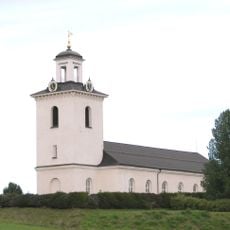
Nora-Skogs församling
3.9 km
Storön
5.5 km
Bråtan
6.6 km
Grannässkogen
3.5 km
Vålö lighthouse
7 km
Käringbergsudden lighthouse
4.6 km
Public beach Hörsångs havsbad
7.5 km
Nora 78:1
7.4 km
Hemsö 58
5.3 km
Högsjö 11:1
7.9 km
Högsjö 20:1
7.8 km
Högsjö 11:4
7.8 km
Borg/Borgliden
3.6 km
Högsjö 11:2
7.8 km
Nora 71:1
6.2 km
Nora 191:1
6.3 km
Nora 151:1
6.8 km
Nora 277:2
6.9 km
Nora 277:1
6.9 km
Nora 72:1
7.3 km
Nora 72:2
7.3 km
Nora 278:1
4.7 km
Borg/Borgliden
3.6 km
Borg/Borgliden
3.6 km
Högsjö 11:3
7.9 km
Trädesmalen
5.5 km
Hålmalen
4.7 km
Halsen
4.6 kmReviews
Visited this place? Tap the stars to rate it and share your experience / photos with the community! Try now! You can cancel it anytime.
Discover hidden gems everywhere you go!
From secret cafés to breathtaking viewpoints, skip the crowded tourist spots and find places that match your style. Our app makes it easy with voice search, smart filtering, route optimization, and insider tips from travelers worldwide. Download now for the complete mobile experience.

A unique approach to discovering new places❞
— Le Figaro
All the places worth exploring❞
— France Info
A tailor-made excursion in just a few clicks❞
— 20 Minutes