2003853 Björk, protected area in Sweden (2003853)
Location: Munkfors Municipality
Inception: April 20, 1948
GPS coordinates: 59.82567,13.53486
Latest update: June 15, 2024 14:50
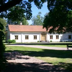
Ransäters bruksherrgård
8.4 km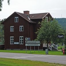
Erlandergården
7.8 km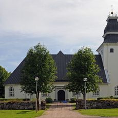
Ransäter Church
7.8 km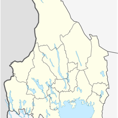
Усадьба Рансберга
7.7 km
Munkfors köping
981 m
Hästskoholmen
2.5 km
Norra Råda 19:3
11.1 km
Hästskoholmen, public beach
2.4 km
Munkfors bruk
2.3 km
Norra Råda 19:5
11.1 km
Ransäters Hembygdsgård
6.6 km
Tall
7.5 km
Östra Maggeby säter
10.7 km
Södra Ävja torp
10.6 km
Övre Ullerud 161:1
10.3 km
Sunnemo 89:1
8.3 km
Övre Ullerud 63:1
10.4 km
Övre Ullerud 156:1
10.8 km
Sunnemo 91:1
9.2 km
Munkfors herrgård och Martinverk
2.3 km
Sunnemo 153:1
10.3 km
Södra Olsätterstorp
10.3 km
Ransäter 207
6.8 km
Munkforsen
2.5 km
Installation artwork, Work of art
6.7 km
Flintgruva
1.4 km
Waterfall
10.9 km
Ransäters hembygdsgård
6.6 kmReviews
Visited this place? Tap the stars to rate it and share your experience / photos with the community! Try now! You can cancel it anytime.
Discover hidden gems everywhere you go!
From secret cafés to breathtaking viewpoints, skip the crowded tourist spots and find places that match your style. Our app makes it easy with voice search, smart filtering, route optimization, and insider tips from travelers worldwide. Download now for the complete mobile experience.

A unique approach to discovering new places❞
— Le Figaro
All the places worth exploring❞
— France Info
A tailor-made excursion in just a few clicks❞
— 20 Minutes