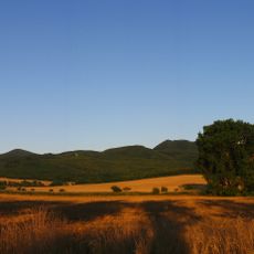
Ostrý vrch, natuurgebied in Okres Trenčín, Slowakije
Location: Trenčín District
Operator: S CHKO Biele Karpaty
GPS coordinates: 48.84972,18.12167
Latest update: November 25, 2023 00:09
Ostrý
332 m
Bindárka
1.2 km
Trubarka
2.9 km
Prícestná socha sv. Jána Nepom. , socha
3.3 km
Farský kostol sv. Mikuláša, cintorín príkostolný
3 km
Truborka
3.6 km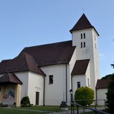
Farský kostol sv. Mikuláša, kostol
3 km
Prícestná socha sv. Jána Nepom. , podstavec
3.3 km
Kaplnka sv. Vendelína
3.2 km
Farský kostol sv. Mikuláša, múr ohradný
3 km
Scenic viewpoint
1.3 km
Scenic viewpoint
3 km
Scenic viewpoint
2.4 km
Brallova skala
2.6 km
Scenic viewpoint
2.7 km
Vehicle
2.4 km
Scenic viewpoint
2 km
Scenic viewpoint
1.9 km
Scenic viewpoint
1.5 km
Scenic viewpoint
2.5 km
Scenic viewpoint
1.3 km
Scenic viewpoint
3.2 km
Statue, Work of art
3.3 km
Scenic viewpoint
1.3 km
Scenic viewpoint
1.1 km
Eine restaurierte Feuerwehrkutsche mit Pumpvorrichtung
3.3 km
Dúbravská skala
3.3 km
Scenic viewpoint
412 mReviews
Visited this place? Tap the stars to rate it and share your experience / photos with the community! Try now! You can cancel it anytime.
Discover hidden gems everywhere you go!
From secret cafés to breathtaking viewpoints, skip the crowded tourist spots and find places that match your style. Our app makes it easy with voice search, smart filtering, route optimization, and insider tips from travelers worldwide. Download now for the complete mobile experience.

A unique approach to discovering new places❞
— Le Figaro
All the places worth exploring❞
— France Info
A tailor-made excursion in just a few clicks❞
— 20 Minutes