Chest opened
+${chestReward.xp} XP
Explorer
NOUVEAU ×${chestReward.collectible.quantity}
tapez pour fermer
Chest locked

Open chests in the app

Around Us is built for your phone — chests unlock when you walk, explore and capture nearby places.

Enable Location

We need your location to show you interesting places around you

Discover nearby places

Find interesting locations and hidden gems around you

Precise directions

Get accurate directions and distances to places

Your location is never shared with other users. It's only used when you tap the location button.

Log in to your account

Start exploring — it's free

Trusted by 73,105 travelers worldwide

Continue with Google
Continue with Apple
or

We will send you a code to connect

By continuing, you accept our Terms and Conditions and our Privacy Policy

Check your inbox

We've sent a pincode in your inbox. Please enter the code below.

Kansas City, Clay County and St. Joseph Railway
Discussion Reviews Photo
1.2k Popularity

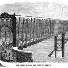
Kansas City, Clay County and St. Joseph Railway, Historic railway route between Kansas City and St. Joseph, Missouri, US

The Kansas City, Clay County and St. Joseph Railway was an electric railway network that extended across Missouri, connecting several communities between two major cities. The system included both passenger and freight service, serving numerous intermediate stops across the region.

Construction of this railway system began in 1911 as a major infrastructure project for Missouri at that time. The network played an important role in connecting communities and provided faster transportation options that transformed how the region operated.

The passenger cars displayed design choices from the early 1900s with their interior finishes and details that shaped the travel experience. This line connected various towns and communities, with each station serving as a gathering place where people from surrounding areas would meet and conduct business.

Trains ran on regular schedules, allowing travelers to move quickly between major cities and smaller towns throughout the service area. Access to the various stations was important for commuters and regional travelers, making the service practical for regular journeys.

The system was one of the most ambitious railway projects of its time in the region, requiring significant workforce effort to construct the infrastructure. The operating fleet was diverse, including different types of vehicles designed for various transportation purposes.

The community of curious travelers

AroundUs brings together thousands of curated places, local tips, and hidden gems, enriched daily by 60,000 contributors worldwide.

Start exploring
GPS coordinates
39.40921,-94.73377
Latest update
December 14, 2025 18:00
Around this place
Weston Bend State Park
United States of America

Weston Bend State Park

12.3 km
Kansas and Missouri Bridge
United States of America

Kansas and Missouri Bridge

16.6 km
Frederick Krause Mansion
United States of America

Frederick Krause Mansion

6 km
United States of America

TWA Administrative Offices Building

12.8 km
Weston Historic District
United States of America

Weston Historic District

14.4 km
Pleasant Ridge United Baptist Church
United States of America

Pleasant Ridge United Baptist Church

10.8 km
Aker Cemetery
United States of America

Aker Cemetery

16.2 km
Platte County Courthouse
United States of America

Platte County Courthouse

5.8 km
United States of America

Downtown Smithville Historic District

13.4 km
Missouri District Warehouse
United States of America

Missouri District Warehouse

5.8 km
United States of America

Paradise Pointe

15.8 km
United States of America

Edgerton City Bandstand

13.8 km
United States of America

Posse Course

16.1 km
United States of America

Academy Course

16 km
McCormick Distillery
United States of America

McCormick Distillery

12.5 km
United States of America

Paradise Point Golf Course

16.2 km
United States of America

Shiloh Springs Golf Course

5.3 km
United States of America

Posse

16.1 km
United States of America

Tiffany Greens Golf Club

16.3 km
United States of America

Outlaw Course

15.8 km
United States of America

Molten Swing

12.4 km
United States of America

United Federation of Doll Clubs, Inc.

14.2 km
United States of America

Work of art, sculpture

10.5 km
United States of America

Scenic viewpoint

12.8 km
United States of America

Scenic viewpoint

16.2 km
United States of America

Scenic viewpoint

13.4 km
United States of America

Scenic viewpoint

13.7 km
United States of America

Cannon

16.8 km
Show the full map
Reviews
Share your experience

No review yet

Discussions
Start a discussion...

No discussion yet

« Kansas City, Clay County and St. Joseph Railway - Historic railway route between Kansas City and St. Joseph, Missouri, US » is provided by Around Us (aroundus.com). Images and texts are derived from Wikimedia project under a Creative Commons license. You are allowed to copy, distribute, and modify copies of this page, under the conditions set by the license, as long as this note is clearly visible.

Discover hidden gems everywhere you go!

From secret cafés to breathtaking viewpoints, skip the crowded tourist spots and find places that match your style. Our app makes it easy with voice search, smart filtering, route optimization, and insider tips from travelers worldwide. Download now for the complete mobile experience.

Around Us App Screenshot

A unique approach to discovering new places

Le Figaro

All the places worth exploring

France Info

A tailor-made excursion in just a few clicks

20 Minutes

Around Us
Travel Guide & Maps
Download

Send to your phone

QR Code
1

Open the camera app on your mobile.

2

Point at the QR code with your camera. A notification will appear.

3

Tap the notification to open the link.