Enable Location

We need your location to show you interesting places around you

Discover nearby places

Find interesting locations and hidden gems around you

Precise directions

Get accurate directions and distances to places

Your location is never shared with other users. It's only used when you tap the location button.

Log in to your account

Start exploring — it's free

Trusted by 62,608 travelers worldwide

Continue with Google
Continue with Apple
or

We will send you a code to connect

By continuing, you accept our Terms and Conditions and our Privacy Policy

Check your inbox

We've sent a pincode in your inbox. Please enter the code below.

Passaic River Parkway

Passaic River Parkway, Scenic parkway in Essex County, New Jersey, United States.

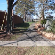
The Passaic River Parkway is a linear green space along the river in Essex County with paths for walking, cycling, and recreation. The system connects several adjoining natural areas that offer varied opportunities for outdoor exploration.

The parkway was created in the mid-20th century as part of urban planning efforts to connect natural spaces with transportation routes along the river. This development transformed public access to the riverbanks.

The parkway brings neighbors together for outdoor enjoyment and learning about the river environment. Local groups gather here regularly for recreation and environmental education programs.

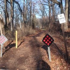
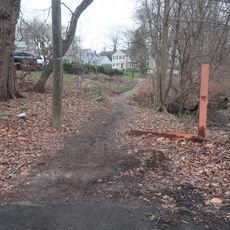
Multiple parking areas and entry points provide access along the parkway with signs directing visitors to recreational facilities and river viewpoints. Plan to wear comfortable shoes and check weather conditions, as some sections can become slippery when wet.

The parkway functions as a natural flood buffer while protecting habitat for migratory birds that rest here during their seasonal journeys. Visitors can observe different bird species throughout the year as they pass through the area.

The community of curious travelers

AroundUs brings together thousands of curated places, local tips, and hidden gems, enriched daily by 60,000 contributors worldwide.

Start exploring
GPS coordinates
40.69528,-74.40111
Latest update
December 14, 2025 16:40
Around this place
Watchung Reservation
United States of America

Watchung Reservation

2.5 km
Summit Playhouse
United States of America

Summit Playhouse

3.7 km
United States of America

Summit Free Public Library

4.1 km
Mount Vernon School
United States of America

Mount Vernon School

3 km
Deacon Andrew Hetfield House
United States of America

Deacon Andrew Hetfield House

4.5 km
Old Baptist Parsonage
United States of America

Old Baptist Parsonage

4.9 km
Nathaniel Smith House
United States of America

Nathaniel Smith House

2.3 km
Summit Downtown Historic District
United States of America

Summit Downtown Historic District

3.7 km
Littel-Lord Farmstead
United States of America

Littel-Lord Farmstead

3.8 km
118 Prospect St, Summit, NJ
United States of America

118 Prospect St, Summit, NJ

3.2 km
Congregation Beth Hatikvah
United States of America

Congregation Beth Hatikvah

4.6 km
Dominican Monastery of Our Lady of the Rosary
United States of America

Dominican Monastery of Our Lady of the Rosary

3.9 km
29 Druid Hill Road, Smmit, NJ
United States of America

29 Druid Hill Road, Smmit, NJ

3 km
24 Oak Ridge Ave, Summit, NJ
United States of America

24 Oak Ridge Ave, Summit, NJ

4.2 km
Record Building
United States of America

Record Building

4.3 km
34 Laurel Avenue, Summi, NJ
United States of America

34 Laurel Avenue, Summi, NJ

3.5 km
41 Sweetbriar Road, Summit, NJ
United States of America

41 Sweetbriar Road, Summit, NJ

2.4 km
49 Baltusrol Road, Summit, NJ
United States of America

49 Baltusrol Road, Summit, NJ

4.2 km
599 Springfield Avenue, Summit, NJ
United States of America

599 Springfield Avenue, Summit, NJ

3.5 km
25 Madison Ave, Summit, NJ
United States of America

25 Madison Ave, Summit, NJ

3.8 km
11 Blackburn Rd, Summit, NJ
United States of America

11 Blackburn Rd, Summit, NJ

3.5 km
17 Stiles Road, Summit, NJ
United States of America

17 Stiles Road, Summit, NJ

4 km
6 Karen Way, Summit, NJ
United States of America

6 Karen Way, Summit, NJ

4.9 km
9 High Street, Summit, NJ
United States of America

9 High Street, Summit, NJ

3.3 km
Sylvan Lane Footpath
United States of America

Sylvan Lane Footpath

4 km
Footpath between Springfield and Nassau
United States of America

Footpath between Springfield and Nassau

3.2 km
Footpath from Colonial to West End
United States of America

Footpath from Colonial to West End

3.4 km
34 Stockton Road, Summit, NJ
United States of America

34 Stockton Road, Summit, NJ

4.1 km
Show the full map
« Passaic River Parkway - Scenic parkway in Essex County, New Jersey, United States » is provided by Around Us (aroundus.com). Images and texts are derived from Wikimedia project under a Creative Commons license. You are allowed to copy, distribute, and modify copies of this page, under the conditions set by the license, as long as this note is clearly visible.

Discover hidden gems everywhere you go!

From secret cafés to breathtaking viewpoints, skip the crowded tourist spots and find places that match your style. Our app makes it easy with voice search, smart filtering, route optimization, and insider tips from travelers worldwide. Download now for the complete mobile experience.

Around Us App Screenshot

A unique approach to discovering new places

Le Figaro

All the places worth exploring

France Info

A tailor-made excursion in just a few clicks

20 Minutes

Around Us
Travel Guide & Maps
Download

Send to your phone

QR Code
1

Open the camera app on your mobile.

2

Point at the QR code with your camera. A notification will appear.

3

Tap the notification to open the link.