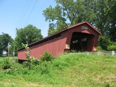
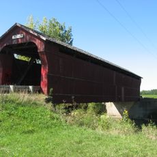
Parker Covered Bridge, Wooden covered bridge in Crane Township, Ohio, US.
Parker Covered Bridge is a wooden bridge with a protective roof spanning a waterway in Crane Township, built with traditional timber trusses that form the core support system. The enclosed design keeps the structural elements sheltered from weather while allowing visitors to walk through and observe the construction techniques closely.
Built in the mid-19th century, the bridge served as a vital transportation link for rural communities in the region. Its recognition on the National Register of Historic Places acknowledges its role in documenting engineering practices of that period.
The National Register of Historic Places recognized the bridge's architectural value, making it one of several preserved covered bridges that demonstrate American rural engineering.
Access is on foot from nearby parking areas, and information signs explain the construction and safety considerations. Plan your visit during daytime to see the wood details and structure clearly.
The bridge preserves original craftsmanship techniques typical of 19th-century Ohio bridge builders and their local construction methods. Regional variations in timber joinery and support systems reveal how different areas developed distinct engineering solutions.
The community of curious travelers
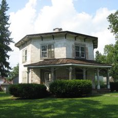
AroundUs brings together thousands of curated places, local tips, and hidden gems, enriched daily by 60,000 contributors worldwide.