Enable Location

We need your location to show you interesting places around you

Discover nearby places

Find interesting locations and hidden gems around you

Precise directions

Get accurate directions and distances to places

Your location is never shared with other users. It's only used when you tap the location button.

Log in to your account

Start exploring — it's free

Trusted by 61,972 travelers worldwide

Continue with Google
Continue with Apple
or

We will send you a code to connect

By continuing, you accept our Terms and Conditions and our Privacy Policy

Check your inbox

We've sent a pincode in your inbox. Please enter the code below.

Dismal Creek

Dismal Creek, Protected natural area in Virginia, United States.

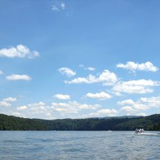
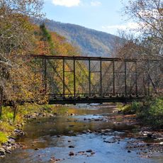
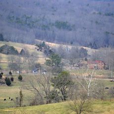
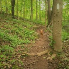
Dismal Creek is a protected natural area located within the George Washington and Jefferson National Forests in Virginia. The site encompasses land ringed by mountains and supports diverse ecosystems across its terrain.

The name comes from the infertile valley soils created by black shale deposits that produce acidic conditions. These geological features made the land unsuitable for farming.

The Wilderness Society designated this location as a Mountain Treasure, recognizing its value for protection from logging and road construction activities.

The area is accessible through multiple trails, including routes that connect with the Appalachian Trail. Visitors can enjoy hiking, fishing, and other outdoor pursuits throughout the site.

The site contains a special biological zone with rare calcium-loving plants such as northern white-cedar. This includes a mineral-rich wetland ecosystem known as a fen.

The community of curious travelers

AroundUs brings together thousands of curated places, local tips, and hidden gems, enriched daily by 60,000 contributors worldwide.

Start exploring
GPS coordinates
37.20917,-80.86694
Latest update
December 12, 2025 09:02
Around this place
Claytor Lake
United States of America

Claytor Lake

26.6 km
Back Creek Farm
United States of America

Back Creek Farm

14.5 km
Haven B. Howe House
United States of America

Haven B. Howe House

23.4 km
Kentland Farm Historic and Archeological District
United States of America

Kentland Farm Historic and Archeological District

25.9 km
Wolf Creek Bridge
United States of America

Wolf Creek Bridge

20.8 km
Fairview District Home
United States of America

Fairview District Home

18.2 km
Crockett's Cove Presbyterian Church
United States of America

Crockett's Cove Presbyterian Church

25.4 km
Andrew Johnston House
United States of America

Andrew Johnston House

17.6 km
Mercer Street Historic District
United States of America

Mercer Street Historic District

26.5 km
Rockwood
United States of America

Rockwood

18 km
Walker's Creek Presbyterian Church
United States of America

Walker's Creek Presbyterian Church

3 km
Giles County Courthouse
United States of America

Giles County Courthouse

17.5 km
Pulaski Historic Commercial District
United States of America

Pulaski Historic Commercial District

21.7 km
Pulaski Historic Residential District
United States of America

Pulaski Historic Residential District

19 km
Pulaski County Courthouse
United States of America

Pulaski County Courthouse

19.4 km
Dalton Theater
United States of America

Dalton Theater

19.7 km
New Dublin Presbyterian Church
United States of America

New Dublin Presbyterian Church

18.5 km
Newbern Historic District
United States of America

Newbern Historic District

21.7 km
Dublin Historic District
United States of America

Dublin Historic District

19.7 km
Spring Dale (Dublin, Virginia)
United States of America

Spring Dale (Dublin, Virginia)

18.9 km
Narrows Commercial Historic District
United States of America

Narrows Commercial Historic District

14.5 km
Belle-Hampton
United States of America

Belle-Hampton

18.5 km
John Hoge House
United States of America

John Hoge House

21.3 km
La Riviere
United States of America

La Riviere

26.3 km
Pulaski South Historic Residential and Industrial District
United States of America

Pulaski South Historic Residential and Industrial District

19.9 km
Junius Marcellus Updyke Farm
United States of America

Junius Marcellus Updyke Farm

17.6 km
Angels Rest Cluster
United States of America

Angels Rest Cluster

5.8 km
Draper Historic District
United States of America

Draper Historic District

25.6 km
Show the full map
« Dismal Creek - Protected natural area in Virginia, United States » is provided by Around Us (aroundus.com). Images and texts are derived from Wikimedia project under a Creative Commons license. You are allowed to copy, distribute, and modify copies of this page, under the conditions set by the license, as long as this note is clearly visible.

Discover hidden gems everywhere you go!

From secret cafés to breathtaking viewpoints, skip the crowded tourist spots and find places that match your style. Our app makes it easy with voice search, smart filtering, route optimization, and insider tips from travelers worldwide. Download now for the complete mobile experience.

Around Us App Screenshot

A unique approach to discovering new places

Le Figaro

All the places worth exploring

France Info

A tailor-made excursion in just a few clicks

20 Minutes

Around Us
Travel Guide & Maps
Download

Send to your phone

QR Code
1

Open the camera app on your mobile.

2

Point at the QR code with your camera. A notification will appear.

3

Tap the notification to open the link.