Enable Location

We need your location to show you interesting places around you

Discover nearby places

Find interesting locations and hidden gems around you

Precise directions

Get accurate directions and distances to places

Your location is never shared with other users. It's only used when you tap the location button.

Virginia Road

Log in to your account

Start exploring — it's free

Trusted by 62,589 travelers worldwide

Continue with Google
Continue with Apple
or

We will send you a code to connect

By continuing, you accept our Terms and Conditions and our Privacy Policy

Check your inbox

We've sent a pincode in your inbox. Please enter the code below.

Virginia Road

Virginia Road, historic road

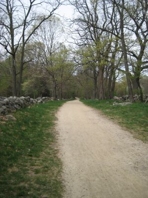
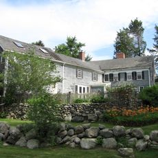
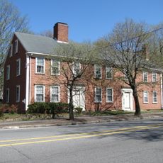
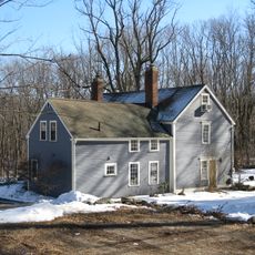
Virginia Road is a historic street in Lincoln, Massachusetts, connecting old houses and farms that span several centuries. It runs from Massachusetts Route 2A in the east to Old Bedford Road in the west, with buildings and terrain that tell stories of early settlement and colonial life.

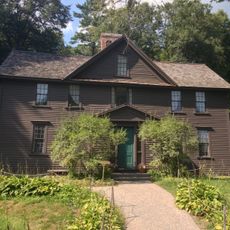
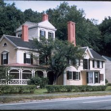
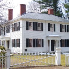
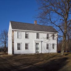
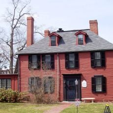
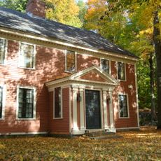
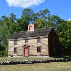
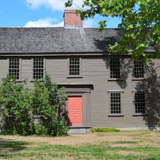
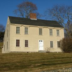
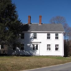
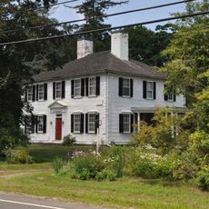
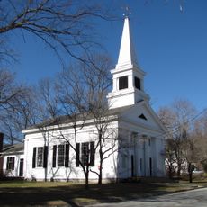
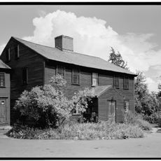
The road was once the main route between Lexington and Concord, playing a role during the American Revolution, especially on April 19, 1775, when British soldiers were ambushed at a spot called the Bloody Angle. Colonists like Captain William Smith, who built his house in 1692, and the Hartwell family, whose tavern from the 1730s still stands today, settled the area.

Virginia Road carries a name connected to early settlement and the families who shaped the area. Today, visitors walk here to connect with the past and see the old houses and farms that remain as reminders of how people once lived.

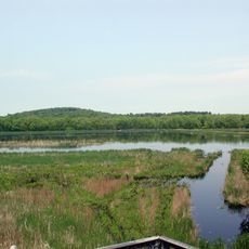
The road is easy to explore on foot, with gentle rolling terrain and trees providing shade along the sides. The area is quiet and not heavily trafficked, making it suitable for leisurely walking and sightseeing.

At a spot called Bloody Angle, British soldiers were ambushed during their retreat on April 19, 1775, marking one of the opening moments of the American Revolution. This quiet corner holds one of the most pivotal scenes from a day that changed the nation.

The community of curious travelers

AroundUs brings together thousands of curated places, local tips, and hidden gems, enriched daily by 60,000 contributors worldwide.

Start exploring
Location
GPS coordinates
42.45814,-71.29712
Latest update
February 9, 2026 11:07
Around this place
Gropius House
United States of America

Gropius House

4.3 km
Old North Bridge
United States of America

Old North Bridge

4.6 km
Orchard House
United States of America

Orchard House

3.2 km
The Old Manse
United States of America

The Old Manse

4.4 km
The Wayside
United States of America

The Wayside

3 km
Ralph Waldo Emerson House
United States of America

Ralph Waldo Emerson House

3.9 km
DeCordova Museum and Sculpture Park
United States of America

DeCordova Museum and Sculpture Park

3.2 km
Concord Museum
United States of America

Concord Museum

3.7 km
Great Meadows National Wildlife Refuge
United States of America

Great Meadows National Wildlife Refuge

3.3 km
Wheeler-Minot Farmhouse
United States of America

Wheeler-Minot Farmhouse

1.7 km
Wright's Tavern
United States of America

Wright's Tavern

4.3 km
Concord Free Public Library
United States of America

Concord Free Public Library

4.6 km
Reuben Brown House
United States of America

Reuben Brown House

4 km
Captain William Smith House
United States of America

Captain William Smith House

1.1 km
Woods End Road Historic District
United States of America

Woods End Road Historic District

4.3 km
Concord Monument Square-Lexington Road Historic District
United States of America

Concord Monument Square-Lexington Road Historic District

4.1 km
Jacob Whittemore House
United States of America

Jacob Whittemore House

2.6 km
Wheeler-Merriam House
United States of America

Wheeler-Merriam House

1.4 km
Henry Higginson House
United States of America

Henry Higginson House

3.7 km
Hoar Tavern
United States of America

Hoar Tavern

3 km
Bedford Center Historic District
United States of America

Bedford Center Historic District

4 km
Simonds Tavern
United States of America

Simonds Tavern

4.5 km
Daniel Brooks House
United States of America

Daniel Brooks House

1.6 km
Flint House
United States of America

Flint House

3.3 km
Colonel Timothy Jones House
United States of America

Colonel Timothy Jones House

2.9 km
Lincoln Center Historic District
United States of America

Lincoln Center Historic District

3.9 km
Samuel Hartwell House
United States of America

Samuel Hartwell House

787 m
Concord Free Public Library
United States of America

Concord Free Public Library

4.6 km
Show the full map
« Virginia Road - historic road » is provided by Around Us (aroundus.com). Images and texts are derived from Wikimedia project under a Creative Commons license. You are allowed to copy, distribute, and modify copies of this page, under the conditions set by the license, as long as this note is clearly visible.

Discover hidden gems everywhere you go!

From secret cafés to breathtaking viewpoints, skip the crowded tourist spots and find places that match your style. Our app makes it easy with voice search, smart filtering, route optimization, and insider tips from travelers worldwide. Download now for the complete mobile experience.

Around Us App Screenshot

A unique approach to discovering new places

Le Figaro

All the places worth exploring

France Info

A tailor-made excursion in just a few clicks

20 Minutes

Around Us
Travel Guide & Maps
Download

Send to your phone

QR Code
1

Open the camera app on your mobile.

2

Point at the QR code with your camera. A notification will appear.

3

Tap the notification to open the link.