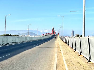
An Dong Bridge, Bridge in Ninh Thuan, Vietnam
Location: Ninh Thuận
Location: Phan Rang–Tháp Chàm
Location: Ninh Phước
GPS coordinates: 11.54426,109.01816
Latest update: November 15, 2025 02:16

Po Klong Garai Temple
10.1 km
Nui Chua National Park
22.7 km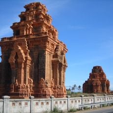
Thap Hoa Lai
14.8 km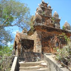
Tháp Po Rome
17.3 km
Nhà Ngoại TT
7.4 km
View Point
22.8 km
Ninh Chu Bridge
6.2 km
Hao Chu Hi
26.7 km
Núi Ya Bo
25.6 km
Hòn Đỏ
12.3 km
Hải đăng Mũi Dinh
20.4 km
Nam Cuong Sand Dunes
3.7 km
Nam Cuong Sand Dunes
4.6 km
Biển Bình Sơn
2.2 km
Cà Ná
26.8 km
La Sentinelle
27.4 km
View Point
23.3 km
Scenic viewpoint
25.9 km
View Point
21.6 km
Hoàn Cầu Resort
3.3 km
View Tower
2.6 km
Turtle Bay
19.1 km
Trụ 70 (xdm)
20 km
Tháp Hòa Lai
14.8 km
Big Rock
20.4 km
Tháp Po Rome
17.3 km
Ban QLDA Mũi Dinh
19.5 km
Tượng đài chiến thắng tỉnh Ninh Thuận
3.2 kmReviews
Visited this place? Tap the stars to rate it and share your experience / photos with the community! Try now! You can cancel it anytime.
Discover hidden gems everywhere you go!
From secret cafés to breathtaking viewpoints, skip the crowded tourist spots and find places that match your style. Our app makes it easy with voice search, smart filtering, route optimization, and insider tips from travelers worldwide. Download now for the complete mobile experience.

A unique approach to discovering new places❞
— Le Figaro
All the places worth exploring❞
— France Info
A tailor-made excursion in just a few clicks❞
— 20 Minutes