Tân Phong, Landgemeinde in Vietnam
Location: Cai Lậy
Elevation above the sea: 4 m
GPS coordinates: 10.30250,106.05611
Latest update: November 15, 2025 10:38


Mỹ Thuận Bridge
16.3 km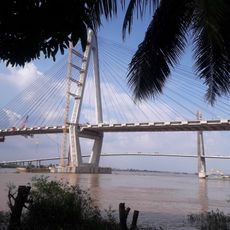
My Thuan 2 Bridge
16.6 km
Cầu Ba Rài
4.4 km
Nhà đan rế
10.7 km
Nhà đan rổ
11 km
Nhà làm hủ tíu
12.1 km
Cơ sở làm bánh rế
2.3 km
Lò gạch
9.6 km
Công thần miếu
9 km
Nhà đan nón
12.3 km
Cơ sở làm võng
2.1 km
Làm chòm lá
2.1 km
Cơ sở tham quan làm nón
2.3 km
Văn Thánh Miếu Vĩnh Long
10.2 km
An Bình
8.3 km
Frugt stop med lokal musik
3 km
Mekong Tour Traditional Vietnamese Music Performance
8.2 km
Cai Cuong ancient house
5.6 km
Honey bee farm
3 km
Ferme pépinière Tam ho
8.1 km
Pépinière
7.7 km
Khu Du Lịch Vinh Sang
11.8 km
Trung tâm hành hương Đức mẹ Fatima
13.9 km
Nha
11.4 km
Bến đò đan lục bình
2.1 km
128 hậu thuận hậu thành cái bè tiền giang
10 km
My Tho River Viewpoint
21.2 km
Bia tưởng niệm Trương Vĩnh Ký
20.8 kmReviews
Visited this place? Tap the stars to rate it and share your experience / photos with the community! Try now! You can cancel it anytime.
Discover hidden gems everywhere you go!
From secret cafés to breathtaking viewpoints, skip the crowded tourist spots and find places that match your style. Our app makes it easy with voice search, smart filtering, route optimization, and insider tips from travelers worldwide. Download now for the complete mobile experience.

A unique approach to discovering new places❞
— Le Figaro
All the places worth exploring❞
— France Info
A tailor-made excursion in just a few clicks❞
— 20 Minutes