Trường Thành, Landgemeinde in Vietnam
Location: An Lão
Elevation above the sea: 6 m
GPS coordinates: 20.84806,106.56056
Latest update: November 16, 2025 06:17

Haiphong Opera House
12.7 km
Hoang Van Thu Bridge
12.4 km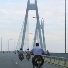
Bính Bridge
11.6 km
Hai Phòng Cathedral
12.6 km
Lac Long Bridge
12.4 km
Old ship
11.5 km
Nhà Hát Thành phố Hải Phòng
12.7 km
Quang Thanh Bridge
7 km
Công viên
8.5 km
Đồi Thiên Văn
8.6 km
Lối vào đại đức
6 km
Khue Bridge
11.8 km
Old Battlement
11.3 km
Train street
12.8 km
Tam Bac Bridge
11 km
Tượng Phật
1.2 km
Kien An Bridge
7.4 km
Rạp Tháng Tám
12.7 km
Đình Kiền Bái
11.4 km
Mural, Work of art
12.6 km
Sculpture, Work of art
10.8 km
Thu tiền điện PG
9.7 km
Tượng đài Nữ tướng Lê Chân
12.4 km
Chùa An Dương
10.9 km
Đền thờ Bác Hồ
9.4 km
Castle
12 km
Cột khói Nhà máy Xi măng
11.3 km
Đình Khúc Trì
7.6 kmReviews
Visited this place? Tap the stars to rate it and share your experience / photos with the community! Try now! You can cancel it anytime.
Discover hidden gems everywhere you go!
From secret cafés to breathtaking viewpoints, skip the crowded tourist spots and find places that match your style. Our app makes it easy with voice search, smart filtering, route optimization, and insider tips from travelers worldwide. Download now for the complete mobile experience.

A unique approach to discovering new places❞
— Le Figaro
All the places worth exploring❞
— France Info
A tailor-made excursion in just a few clicks❞
— 20 Minutes