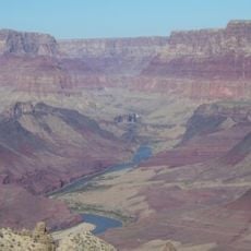
Banta Point, cliff in Coconino County, Arizona, United States of America
Location: Coconino County
GPS coordinates: 36.21778,-111.91333
Latest update: November 20, 2025 16:27

Temple Butte
10.1 km
Cape Final Trail
8.2 km
Walhalla Glades Trail
4.8 km
Hancock Butte
7.4 km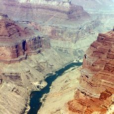
Nankoweap Mesa
7.5 km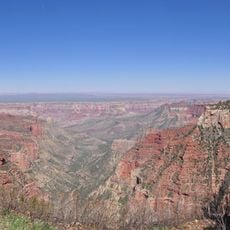
Atoko Point
2 km
Kibbey Butte
6.9 km
Seiber Point
9.2 km
Bourke Point
7.3 km
Francois Matthes Point
9.5 km
Point Imperial
8.9 km
Desert Facade
9.4 km
Chiavria Point
5.2 km
Roosevelt Point
3.6 km
Jeffords Point
1.3 km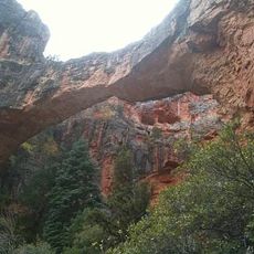
Hartman Natural Bridge
2.6 km
Ehrenberg Point
5.4 km
Naji Point
5.2 km
Mystic Falls
9.2 km
Kolb Arch
8.9 km
Cape Final
8.4 km
Natural Arch
4.4 km
Bourke Point View
3.8 km
Walhalla Overlook
9.9 km
Roosevelt Lookout
3.5 km
Point Imperial
8.9 km
Waterfall
8.9 km
Cheyava Falls
9.7 kmReviews
Visited this place? Tap the stars to rate it and share your experience / photos with the community! Try now! You can cancel it anytime.
Discover hidden gems everywhere you go!
From secret cafés to breathtaking viewpoints, skip the crowded tourist spots and find places that match your style. Our app makes it easy with voice search, smart filtering, route optimization, and insider tips from travelers worldwide. Download now for the complete mobile experience.

A unique approach to discovering new places❞
— Le Figaro
All the places worth exploring❞
— France Info
A tailor-made excursion in just a few clicks❞
— 20 Minutes