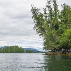
Namu Corridor Conservancy, protected area in British Columbia, Canada
Location: Central Coast Regional District
GPS coordinates: 51.91444,-127.74639
Latest update: November 26, 2025 22:32
Penrose Island Marine Provincial Park
50.5 km
Codville Lagoon Marine Provincial Park
17.6 km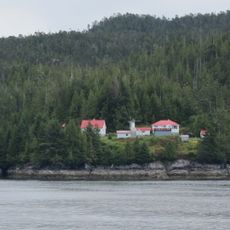
Addenbroke Island light station
35.6 km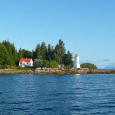
Dryad Point Lighthouse
39.2 km
Pointer Island Light
21.4 km
Koeye Conservancy
13.7 km
Restoration Bay Conservancy
14.4 km
Clyak Estuary Conservancy
27.1 km
Codville Lagoon Conservancy
16.7 km
Kwatna Estuary Conservancy
32.8 km
Kilbella Estuary Conservancy
35.4 km
Penrose-Ripon Conservancy
46.9 km
Hakai Conservation Study Area
17.5 km
Calvert Island Conservancy
47.6 km
Troup Passage Conservancy
43.1 km
Sea Bluff
49.8 km
North Beach
39 km
West Beach
39.6 km
Purple Bluff
38.3 km
The Rapids
29 km
Cliff Bluff
27.1 km
Namu Conservancy
5.1 km
Hakai Lúxvbálís Conservancy
31.6 km
Scenic viewpoint
40.4 km
Waterfall
42.1 km
Waterfall
20.2 km
Waterfall
45.7 km
Waterfall
45.7 kmReviews
Visited this place? Tap the stars to rate it and share your experience / photos with the community! Try now! You can cancel it anytime.
Discover hidden gems everywhere you go!
From secret cafés to breathtaking viewpoints, skip the crowded tourist spots and find places that match your style. Our app makes it easy with voice search, smart filtering, route optimization, and insider tips from travelers worldwide. Download now for the complete mobile experience.

A unique approach to discovering new places❞
— Le Figaro
All the places worth exploring❞
— France Info
A tailor-made excursion in just a few clicks❞
— 20 Minutes