Wiese im Oswaldtal, Naturdenkmal in Grünhain-Beierfeld
Location: Grünhain-Beierfeld
GPS coordinates: 50.57534,12.83360
Latest update: November 20, 2025 06:47
Grünhain Abbey
1.7 km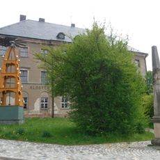
Amtshaus Grünhain
1.7 km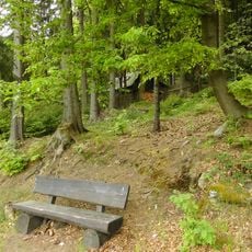
Oswaldtal
1.5 km
Wohnhaus in offener Bebauung Pförtelsteig 1
1.6 km
Prinz-Friedrich-August-Höhe
1.3 km
Häuslerhaus mit integriertem Scheunenteil Talstraße 45
1.5 km
Waldwiese am Pförtelsteig
1 km
Gasthaus Fürstenbrünner Straße 2
1.7 km
Ackerbürgerhaus in offener Bebauung Schwarzenberger Straße 21
1.6 km
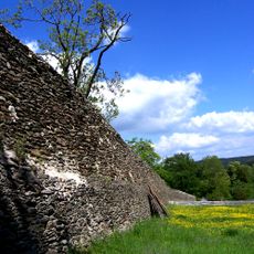
Klosterwald Grünhain
1.5 km
Wohnstallhaus und Scheune eines Winkelhofes Hinterdorfer Straße 20
1.4 km
Niedere Mühle (ehem.) Grünhain
1.3 km
Wettinstein Elterlein
1.3 km
Freilichtbühne
951 m
Scenic viewpoint
1.5 km
Freilichtbühne
1.5 km
Mönch
1.7 km
Schwein
1.1 km
Eule
1.1 km
Scenic viewpoint
1.2 km
Natur- und Wildpark Waschleithe
975 m
Scenic viewpoint
1 km
Karlsruhe
1.4 km
Scenic viewpoint
955 m
Heil Wettin 1889
1.3 km
Ehrenmal 1. Weltkrieg
1.1 km
Fundamente Klosterkirche Grünhain
1.5 km
Wayside cross
1.5 kmReviews
Visited this place? Tap the stars to rate it and share your experience / photos with the community! Try now! You can cancel it anytime.
Discover hidden gems everywhere you go!
From secret cafés to breathtaking viewpoints, skip the crowded tourist spots and find places that match your style. Our app makes it easy with voice search, smart filtering, route optimization, and insider tips from travelers worldwide. Download now for the complete mobile experience.

A unique approach to discovering new places❞
— Le Figaro
All the places worth exploring❞
— France Info
A tailor-made excursion in just a few clicks❞
— 20 Minutes