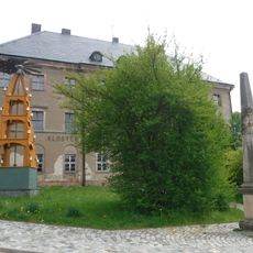
Grünhain Abbey, Cistercian monastery ruins in Grünhain-Beierfeld, Germany.
Grünhain Abbey is a monastery ruin with preserved stone foundations and wall fragments from the Middle Ages, including remains of the former church and the Fuchsturm washing house complex. The remaining structures show clearly how the different buildings were once arranged and what functions they served.
The monastery was founded in 1233 by Meinhard II of Wirbene and quickly grew into an influential estate controlling numerous villages and towns. It was dissolved in 1536 during the Reformation, when religious changes ended the Church's power in the region.
The name comes from the green meadow where it was built, and today exhibitions bring the monastic life to light through displays of daily routines and prayer practices. Visitors can sense how the community shaped its existence within these walls.
The grounds are located on Zwönitzer Straße in Grünhain-Beierfeld and are accessible to visitors who can read the information boards on site. It helps to allow time to study the layouts and understand how the different areas were positioned.
The monastery was strategically positioned along the salt trade route to Bohemia, which brought it economic wealth that transformed the region from purely agricultural land into a trading hub. This location made it more than a religious site, but also a key economic center of its time.
Location: Grünhain-Beierfeld
Inception: 1233
Address: Zwönitzer Straße 12; 14; 14a; 16
GPS coordinates: 50.57960,12.81110
Latest update: December 8, 2025 21:01
Spiegelwald
1.4 km
Schatzenstein
2.8 km
Saint Nicholas Church (Grünhain)
283 m
Rittergut Sachsenfeld
4 km
Christuskirche (Beierfeld)
2.7 km
Saints Peter and Paul Church
2.7 km
Pfarrkirche zur Ehre Gottes
2.8 km
Kuttenbach
3.9 km
Polish-Saxon Post Milestone in Grünhain
102 m
Amtshaus Grünhain
95 m
Oswaldtal
1.5 km
King-Albert-Tower
1.4 km
Kirche (mit Ausstattung), Kirchhof mit Einfriedungsmauer und zwei Kirchhofstoren sowie Parentationshalle auf der Friedhofserweiterung an der Geyerschen Straße Kirchgasse -
4.1 km
Gedenkstein zur Erinnerung an den Prinzenraub von 1455 Am Fürstenberg 7 (bei)
3.3 km
Ruine einer Wallfahrtskirche („Dudelskirche“) Talstraße -
3.4 km
Kuttenbach, Moosheide und Vordere Aue
3.9 km
Wiese Freibergteich
3.4 km
Fuchsbrunnbrücke
3.1 km
Polish-Saxon Post Milestone in Elterlein
4 km
Sachgesamtheit Christuskirche (Beierfeld) und Friedhof August-Bebel-Straße 71
2.6 km
Bahnhof Elterlein
3.8 km
Station 133 Schatzenstein
2.8 km
Einzeldenkmale der Sachgesamtheit Ehemaliges Zisterzienser-Kloster St. Maria und St. Nikolaus Zwönitzer Straße 12; 14a; 16
111 m
Rathaus Schwarzenberger Straße 10
248 m
Pfarrhaus Kirchgasse 3
4.1 km
Wohnhaus in offener Bebauung Schwarzenberger Straße 12
245 m
Dorfbach Bernsbach
3.9 km
Pfarrhaus mit vorgelagerter Treppe und Stützmauer Markt 1
307 mVisited this place? Tap the stars to rate it and share your experience / photos with the community! Try now! You can cancel it anytime.
Discover hidden gems everywhere you go!
From secret cafés to breathtaking viewpoints, skip the crowded tourist spots and find places that match your style. Our app makes it easy with voice search, smart filtering, route optimization, and insider tips from travelers worldwide. Download now for the complete mobile experience.
A unique approach to discovering new places❞
— Le Figaro
All the places worth exploring❞
— France Info
A tailor-made excursion in just a few clicks❞
— 20 Minutes