Schatzenstein, Mountain summit in Erzgebirgskreis, Germany.
Description
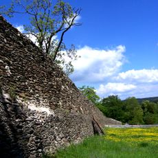
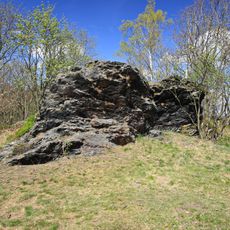
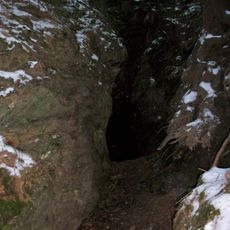
Schatzenstein is a mountain summit in the Erzgebirge region whose slopes are shaped by distinctive phyllite cliffs that rise up to 10 meters high. The terrain feels rocky and steep in places, creating varied walking conditions as you move across the landscape.
History
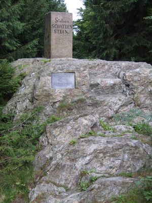
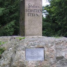
The summit bears a survey marker from the Kingdom of Saxony's mapping campaign between 1862 and 1890, which was crucial for recording the region's geography. This marker represents a connection to the long history of documenting the landscape.
Culture
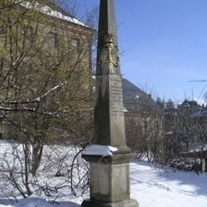
A commemorative plaque at the site honors Max Schreyer, a local forester and poet who shaped the region. His connection to this place shows how nature and human creativity have long been linked here.
Practical
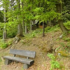
The mountain is accessible via several hiking trails that vary in length and difficulty. You can choose shorter loops or longer routes depending on your fitness level and available time.
Did you know?
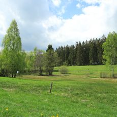
The summit sits on a watershed divide, meaning water from this location flows toward two different rivers depending on which way it runs. This geographic feature makes the mountain significant for understanding how the landscape naturally drains.
AroundUs brings together thousands of curated places, local tips, and hidden gems, enriched daily by 60,000 contributors worldwide. Discover all places nearby (Erzgebirgskreis).
Sender Geyer
3.7 km
Grünhain Abbey
2.8 km
Barbara-Uttmann-Denkmal
2.6 km
Spiegelwald
4.2 km
Hermannsdorfer Wiesen
3.6 km
Saint Nicholas Church (Grünhain)
3 km
Dorfkirche Schwarzbach
3.7 km
Polish-Saxon Post Milestone in Grünhain
2.9 km
Amtshaus Grünhain
2.9 km
Oswaldtal
3.5 km
King-Albert-Tower
4.1 km
Austelvilla Niederzwönitz
4.5 km
Gebert-Felsen
3.3 km
Leuchtmooshöhle Burgstädtel
1.8 km
Kuttenbach, Moosheide und Vordere Aue
4.5 km
Kirche (mit Ausstattung), Kirchhof mit Einfriedungsmauer und zwei Kirchhofstoren sowie Parentationshalle auf der Friedhofserweiterung an der Geyerschen Straße Kirchgasse -
2.5 km
Wiese Freibergteich
2.9 km
Station 133 Schatzenstein
4 m
Fuchsbrunnbrücke
4.4 km
Wohnmühlenhaus (mit Mühlentechnik), daran angebautes Seitengebäude, Mühlgraben und Teich eines Mühlenanwesens Schwarzbach (Elterlein)
4 km
Royal Saxon milestone Burgstädtel
2.2 km
Polish-Saxon Post Milestone in Elterlein
2.4 km
Bahnhof Elterlein
2.3 km
Mühlgraben
3.4 km
Einzeldenkmale der Sachgesamtheit Ehemaliges Zisterzienser-Kloster St. Maria und St. Nikolaus Zwönitzer Straße 12; 14a; 16
2.9 km
Rathaus Schwarzenberger Straße 10
3 km
Pfarrhaus Kirchgasse 3
2.5 km
Pfarrhaus mit vorgelagerter Treppe und Stützmauer Markt 1
3.1 kmDiscover hidden gems everywhere you go!
From secret cafés to breathtaking viewpoints, skip the crowded tourist spots and find places that match your style. Our app makes it easy with voice search, smart filtering, route optimization, and insider tips from travelers worldwide. Download now for the complete mobile experience.
A unique approach to discovering new places❞
— Le Figaro
All the places worth exploring❞
— France Info
A tailor-made excursion in just a few clicks❞
— 20 Minutes