Brunnen, هيكل معماري في روديشيم أم راين، ألمانيا
Location: Rüdesheim am Rhein
Address: Hauptstraße (L 3034)
GPS coordinates: 49.99385,7.89059
Latest update: November 20, 2025 05:33
Landschaftspark Niederwald
1.3 km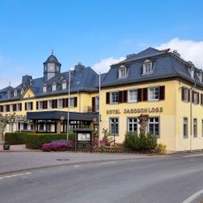
Jagdschloss Niederwald
1.1 km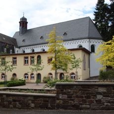
Kloster Marienhausen
430 m
Jagdschloss Niederwald
1.1 km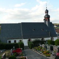
St. Petronilla
23 m
Besucherzentrum auf dem Niederwald
1.5 km
Katholische Kirche St. Petronilla
26 m
Bacharacher Kopf
1.5 km
St. Vincenz-Stift
1 km
Friedhofskreuz
98 m
Friedhofskreuz
1.5 km
Wegekreuz
131 m
Maria-Hilf-Kapelle
1.4 km
Haus Aulhauser Straße 7
1.3 km
Staatsweingut Assmannshausen
867 m
Haus Hauptstraße 40
18 m
Krufter Kreuz
1.5 km
Haus Hauptstraße 31
17 m
Jagdschloss Niederwald
1.1 km
Landschaftspark Niederwald
1.1 km
Ehem. Kloster Marienhausen
441 m
Wildpark Niederwald
1.2 km
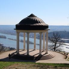
Temple
1.5 km
Scenic viewpoint
1.6 km
Wayside cross
1.5 km
Wayside cross
1.5 km
Wayside shrine
218 m
Historischer Töpferofen
62 mReviews
Visited this place? Tap the stars to rate it and share your experience / photos with the community! Try now! You can cancel it anytime.
Discover hidden gems everywhere you go!
From secret cafés to breathtaking viewpoints, skip the crowded tourist spots and find places that match your style. Our app makes it easy with voice search, smart filtering, route optimization, and insider tips from travelers worldwide. Download now for the complete mobile experience.

A unique approach to discovering new places❞
— Le Figaro
All the places worth exploring❞
— France Info
A tailor-made excursion in just a few clicks❞
— 20 Minutes