Belsar's Hill, Archaeological site in Willingham, England.
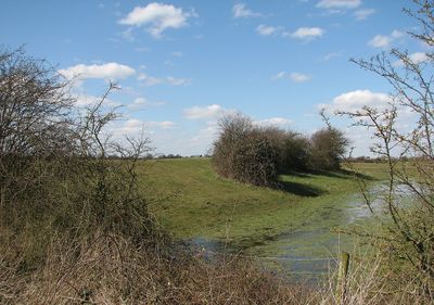
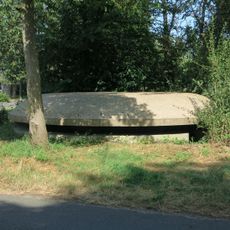
Belsar's Hill is a ringwork earthwork with a pear-shaped outline measuring approximately 270 meters in length and 230 meters in width. A single bank with a surrounding ditch system forms the defensive boundary that runs around the entire perimeter.
This earthwork was built following the Norman Conquest and later adapted for medieval agricultural purposes. The different historical names recorded over time reveal how the site's importance and use shifted across the centuries.
The names given to this place over time, such as Alrehede and Belassise, reflect its deep connection to the wetland landscape. Visitors walking through can sense how the terrain and water shaped the way people chose to live and build here.
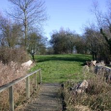
The site is located roughly one and a half kilometers east of the local church and is accessible on foot during dry periods. The earthen banks become more visible after rainfall, when moisture in the soil enhances the definition of the structures.
The ditch surrounding the earthwork retains water throughout the year, revealing its original design as a marsh fort. This water-retaining characteristic makes the ancient defensive strategy still visible to modern visitors.
The community of curious travelers
AroundUs brings together thousands of curated places, local tips, and hidden gems, enriched daily by 60,000 contributors worldwide.