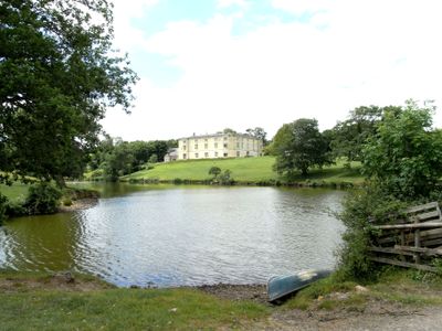
Great Fulford, Tudor estate in Dunsford, England
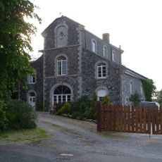
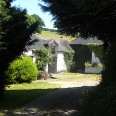
Great Fulford is a Tudor estate in Dunsford, England, covering around 3,000 acres with castellated rooflines, tall bay windows, and an entrance displaying carved heraldic supporters. The complex includes a large red sandstone manor, outbuildings, and sprawling grounds with mature trees and formal gardens.
The Fulford family received the property in 1199 from Richard the Lionheart for their service during the Crusades. The present Tudor house was built in the 16th century on foundations from an earlier Norman structure.
The Saracens carved above the entrance arrived as decorative figures after a family member returned from the Holy Land. These stone supporters appear on the coat of arms and mark the house as tied to events from medieval campaigns.
Visitors can book guided tours by appointment and reserve the grounds for weddings, corporate gatherings, or photography shoots. The historic rooms and gardens work well for smaller groups seeking quiet and a countryside setting.
The property became the setting for a television documentary showing daily life for the current residents and their efforts to maintain a Grade I listed building. This public exposure helps cover ongoing costs and secure the future of the house.
GPS coordinates: 50.71222,-3.71472
Latest update: December 5, 2025 22:28
Wooston Castle
3.3 km
Church of St Mary
3.2 km
Church of St Mary
3.4 km
Church of St Mary the Virgin
2.5 km
Clifford Bridge
2.1 km
Old Thatch Inn
2 km
Steps Bridge
3.7 km
The Post Office
3.4 km
Dymond Cottage
3.4 km
East Steps East Steps And Foxhole And Garden Wall To The North West Of East Steps Foxhole
3.4 km
Cheriton Cross
2.2 km
Part Of Cross About 8 Metres South Of The Transept Of The Church Of St Mary
3.2 km
House At Iron Mills
3.6 km
Coach-House Approx 60M North-East Of Woodleigh Hall
1.9 km
3 Adjacent Roadside Milestones Set In Middle Of Stone Wall Approx 18M West Of Lambert Lane Junction
3.7 km
The Round House
2.1 km
Brook Farmhouse
2.9 km
Tower Lodge
731 m
Old Cawte Farmhouse And Wall To The North West
3.3 km
Stonelands
3.7 km
Southmead Woodland View
3.4 km
K6 Telephone Kiosk
3.4 km
Lockhouse
3.5 km
Scottishill Farmhouse
2.6 km
Mill Building At Iron Mills
3.6 km
Milestone, 800m W of Step's Bridge car park, 30m from top end of crash barrier
3.5 km
Milestone, School Lane, 50m E of small roundabout
3.6 km
Moor Park
2 kmVisited this place? Tap the stars to rate it and share your experience / photos with the community! Try now! You can cancel it anytime.
Discover hidden gems everywhere you go!
From secret cafés to breathtaking viewpoints, skip the crowded tourist spots and find places that match your style. Our app makes it easy with voice search, smart filtering, route optimization, and insider tips from travelers worldwide. Download now for the complete mobile experience.
A unique approach to discovering new places❞
— Le Figaro
All the places worth exploring❞
— France Info
A tailor-made excursion in just a few clicks❞
— 20 Minutes