Enable Location

We need your location to show you interesting places around you

Discover nearby places

Find interesting locations and hidden gems around you

Precise directions

Get accurate directions and distances to places

Your location is never shared with other users. It's only used when you tap the location button.

Slough

Log in to your account

Start exploring — it's free

Trusted by 62,989 travelers worldwide

Continue with Google
Continue with Apple
or

We will send you a code to connect

By continuing, you accept our Terms and Conditions and our Privacy Policy

Check your inbox

We've sent a pincode in your inbox. Please enter the code below.

Discussion Reviews 1 Photos
20k Popularity

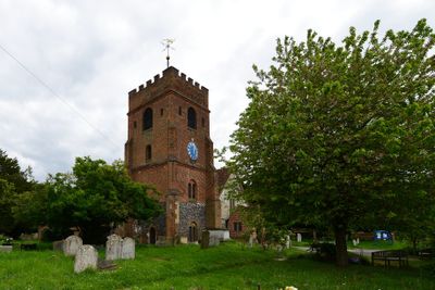
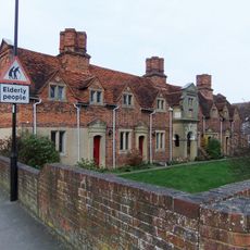
Slough, Administrative borough in Berkshire, England

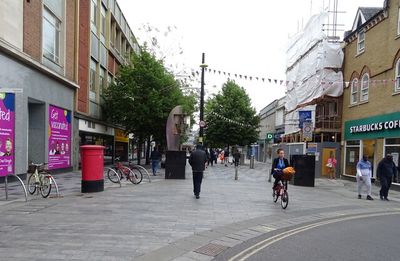
Slough is a borough in Berkshire that sits between London and Reading, mixing residential neighborhoods with business parks and manufacturing areas. The town spreads along the M4 motorway, which runs through the center of the town and shapes its modern structure.

Slough began as a small village but transformed into an industrial hub after 1920 when the Slough Trading Estate was built. This business park became Europe's largest privately owned industrial zone and shaped the town's growth.

The population of 158,500 residents represents multiple ethnic groups, with Asian communities making up nearly half of the total inhabitants according to the 2021 census.

The town has six railway stations offering connections to London Paddington in around 20 minutes, and Heathrow Airport sits close by to the southeast. These transport links make it easy to visit by train or explore the broader region.

The town hosts headquarters of many international companies, making it a major business center beyond central London. This concentration of large corporate offices sets it apart as a destination for those interested in modern commerce.

The community of curious travelers

AroundUs brings together thousands of curated places, local tips, and hidden gems, enriched daily by 60,000 contributors worldwide.

Start exploring
Location
Inception
April 1, 1974
Capital city
Slough
GPS coordinates
51.50000,-0.56667
Latest update
December 12, 2025 05:59
Around this place
Church of St Laurence, Upton-cum-Chalvey
United Kingdom

Church of St Laurence, Upton-cum-Chalvey

1.5 km
St Mary the Virgin Church, Langley
United Kingdom

St Mary the Virgin Church, Langley

1.1 km
Main Gatehouse And Bridge At Admiralty Compass Observatory, At Ditton Park
United Kingdom

Main Gatehouse And Bridge At Admiralty Compass Observatory, At Ditton Park

1.1 km
United Kingdom

West Block And Chapel At St Bernards Convent

864 m
United Kingdom

Houblone Tomb Approximately 1 Metre To East Of North Chapel Of Church Of St. Mary (Q.V.)

1.1 km
United Kingdom

Webb Tomb Approximately 12 Metres To South-West Of Nave Of Church Of St. Mary

1.1 km
The Red Lion Public House
United Kingdom

The Red Lion Public House

1.1 km
United Kingdom

The Rose And Crown Public House Tony's Grill Cafe

1.5 km
2,4,6,8, St Marys Road
United Kingdom

2,4,6,8, St Marys Road

1.1 km
Main Building, Courtyard Walls, Stable And Gatehouse Blocks, Admiralty Compass Observatory At Ditton Park
United Kingdom

Main Building, Courtyard Walls, Stable And Gatehouse Blocks, Admiralty Compass Observatory At Ditton Park

1.1 km
Milestone At Su 9999 7881
United Kingdom

Milestone At Su 9999 7881

419 m
United Kingdom

Barn To South-West Of Ditton Farmhouse

1.4 km
12, 14, 16, 18, 20, 22, St Marys Road
United Kingdom

12, 14, 16, 18, 20, 22, St Marys Road

1.1 km
United Kingdom

Ive Tomb Approximately 3 Metres To The North Of North Aisle Of Church Of St Mary

1.1 km
Milestone, Sussex Place; outside No. 46
United Kingdom

Milestone, Sussex Place; outside No. 46

1.2 km
United Kingdom

74, Upton Road

1.4 km
United Kingdom

Chest Tomb Approximately 3 Metres To North Of Chancel Of Church Of St Laurence

1.5 km
United Kingdom

Pitt Tomb Approximately 13 Metres To South Of Chancel Of Church Of St Laurence

1.5 km
United Kingdom

Ditton Farmhouse

1.4 km
United Kingdom

Ramsden Tomb Approximately 18 Metres To South Of Chancel Of Church Of St Laurence

1.5 km
United Kingdom

Garden Walls And Summer House At Admiralty Compass Observatory At Ditton Park

1.1 km
United Kingdom

Fryer Tomb Approximately 6 Metres To South Of Chancel Of Church Of St Laurence

1.5 km
United Kingdom

Chest Tomb Approximately 36 Metres To The North Of North Aisle Of Church Of St Mary

1.1 km
United Kingdom

Railway Bridge

1 km
United Kingdom

Railway Bridge

1.2 km
United Kingdom

Granary 50 Yds South-West Of Ditton Farmhouse

1.4 km
United Kingdom

Riding Court Farmhouse

1.2 km
United Kingdom

Seymour Tomb Adjoining South Transceptal Chapel Of Church Of St. Mary (Q.V.) To South

1.1 km
Show the full map
Reviews
Share your experience

No review yet

Discussions
Start a discussion...

No discussion yet

« Slough - Administrative borough in Berkshire, England » is provided by Around Us (aroundus.com). Images and texts are derived from Wikimedia project under a Creative Commons license. You are allowed to copy, distribute, and modify copies of this page, under the conditions set by the license, as long as this note is clearly visible.

Discover hidden gems everywhere you go!

From secret cafés to breathtaking viewpoints, skip the crowded tourist spots and find places that match your style. Our app makes it easy with voice search, smart filtering, route optimization, and insider tips from travelers worldwide. Download now for the complete mobile experience.

Around Us App Screenshot

A unique approach to discovering new places

Le Figaro

All the places worth exploring

France Info

A tailor-made excursion in just a few clicks

20 Minutes

Around Us
Travel Guide & Maps
Download

Send to your phone

QR Code
1

Open the camera app on your mobile.

2

Point at the QR code with your camera. A notification will appear.

3

Tap the notification to open the link.