
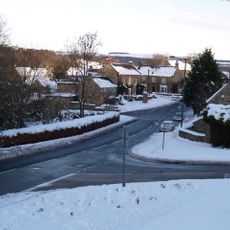
Ebchester Old Bridge, bridge in Shotley Low Quarter, Northumberland, UK
Location: Shotley Low Quarter
GPS coordinates: 54.89446,-1.84510
Latest update: November 15, 2025 00:43
Vindomora
426 m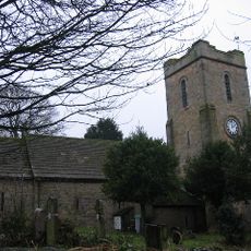
Church of St Ebba
341 m
Ebchester (Vindomora) Roman station
305 m
Demesne Farm Demesne House
256 m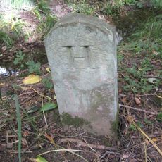
Boundary Stone At Ngr Nz 09705632, On West Side Of Mill Burn
844 m
Beckwith Headstones Circa 10 Metres South Of Vestry Of Church Of At Ebba
351 m
Pound behind School House
312 m
Walls In Front Of Demesne Farm And Demesne House
265 m
Chare Top Cottage
243 m
K6 Telephone Kiosk In Front Of Chare Top Cottage
255 m
Group Of 2 Tombs Circa 5 Metres South Of Vestry Of Church Of St Ebba
342 m
2 Tombs Circa 5 Metres South Of Chancel Of Church Of St Ebba
354 m
Main's Farmhouse
351 m
Leyburn Tombs Circa 7 Metres South Of Nave Of Church Of St Ebba
338 m
St Mary's Convent
517 m
The Former Rectory
309 m
Prospect House
522 m
Burn House
289 m
Outbuilding To South Of Prospect House
545 m
Ebchester Bridge
1 m
Outbuilding North East Of Demesne House
269 m
Wheldon House
244 m
Group Of 5 Tombs Circa 3 Metres South Of Vestry Of Church Of St Ebba
351 m
Church House
308 m
School House
281 m
Jubilee House
290 m
Ebchester War Memorial
331 m
The Heugh
554 mReviews
Visited this place? Tap the stars to rate it and share your experience / photos with the community! Try now! You can cancel it anytime.
Discover hidden gems everywhere you go!
From secret cafés to breathtaking viewpoints, skip the crowded tourist spots and find places that match your style. Our app makes it easy with voice search, smart filtering, route optimization, and insider tips from travelers worldwide. Download now for the complete mobile experience.

A unique approach to discovering new places❞
— Le Figaro
All the places worth exploring❞
— France Info
A tailor-made excursion in just a few clicks❞
— 20 Minutes