
Group Of Tombstones Circa 50 Metres North West Of Dairy Bridge
Group Of Tombstones Circa 50 Metres North West Of Dairy Bridge, tombstone in Rokeby, County Durham, UK
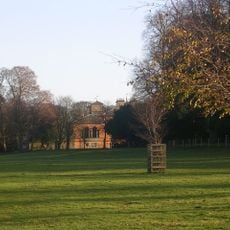
Rokeby Park
383 m
8 Urns On Lawn To South Of Rokeby Park
285 m
Gunroom On North Of Rokeby Park Rear Court
235 m
Garden House, Outbuildings And Walls, To South West Of Rokeby Park
435 m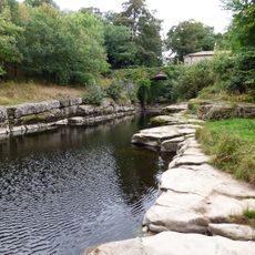
Dairy Bridge Over The River Greta
71 m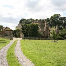
Mortham Tower
287 m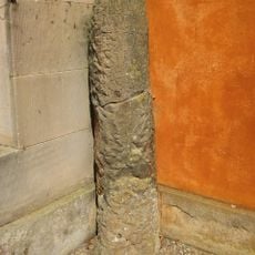
Roman Milestone Against West Wall Of Rokeby Park
270 m
Dairy Bridge Cottage
63 m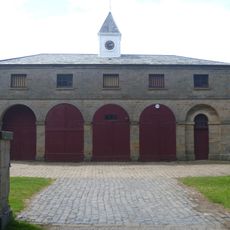
Stable Block 180 Metres South West Of Rokeby Park
458 m
Herm Of Ceres 40 Metres West Of Mortham Tower
276 m
Stable To West Of Rokeby Grove
820 m
Wall Adjoining To East Of East Shaws Farmhouse
1 km
Cross Base Circa 50 Metres North West Of Dairy Bridge
8 m
Farmbuildings To East Of Mortham Tower And Attached Walls
377 m
Remains of St Michael's Church, 50m north west of Dairy Bridge, Rokeby Park
10 m
Stableyard Cottage, To South West Of Rokeby Park
427 m
Piers And Railings 500 Metres South West Of Rokeby Park
757 m
Wall, Ha-Ha Wall And Railings To South Of East Shaws Farmhouse
952 m
Farmbuilding Group To North Of Garden House
400 m
Sir Walter Scott's Grotto, In Bank Of River Greta South West Of Mortham Tower
343 m
Platform With Roman Altars On Lawn West Of Rokeby Park
293 m
Rokeby Grove
826 m
Terrace Wall To South Of Mortham Tower
325 m
Footbridge 220 Metres South East Of Mortham Tower
522 m
Sundial On Lawn West Of Rokeby Park
283 m
East Shaws Farmhouse And Wall Attached To North
986 m
West Lodge And Entrance Screen
518 m
Sundial On Lawn 10 Metres South Of Rokeby Grove
837 mReviews
Visited this place? Tap the stars to rate it and share your experience / photos with the community! Try now! You can cancel it anytime.
Discover hidden gems everywhere you go!
From secret cafés to breathtaking viewpoints, skip the crowded tourist spots and find places that match your style. Our app makes it easy with voice search, smart filtering, route optimization, and insider tips from travelers worldwide. Download now for the complete mobile experience.

A unique approach to discovering new places❞
— Le Figaro
All the places worth exploring❞
— France Info
A tailor-made excursion in just a few clicks❞
— 20 Minutes