Enable Location

We need your location to show you interesting places around you

Discover nearby places

Find interesting locations and hidden gems around you

Precise directions

Get accurate directions and distances to places

Your location is never shared with other users. It's only used when you tap the location button.

Wayland's Smithy

Log in to your account

Start exploring — it's free

Trusted by 61,782 travelers worldwide

Continue with Google
Continue with Apple
or

We will send you a code to connect

By continuing, you accept our Terms and Conditions and our Privacy Policy

Check your inbox

We've sent a pincode in your inbox. Please enter the code below.

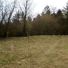
Wayland's Smithy, Neolithic burial ground on the Ridgeway, Oxfordshire, Great Britain.

Description

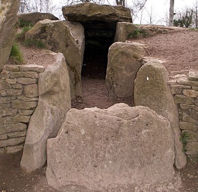
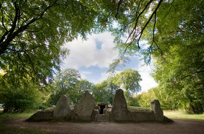
Wayland's Smithy is a Neolithic chambered long barrow on the Ridgeway in Ashbury, Oxfordshire, England. The stone structure holds two opposing side chambers and a terminal chamber, creating a cross-shaped burial area with four large sarsen stones marking the entrance.

History

The initial wooden structure was built between 3590 and 3550 before Christ and contained fourteen burials. Around 3460 before Christ, a larger stone mound was constructed over the original site.

Culture

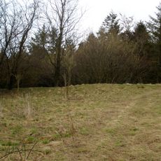
The burial ground takes its name from a Germanic smith-god, a link first recorded in a land deed from 908. Visitors today find a quiet woodland clearing with moss-covered stones, often visited by walkers following the ancient ridgeway route.

Practical

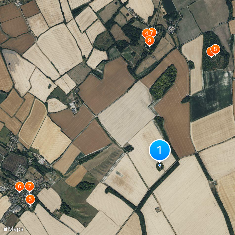
Access requires a walk of about one mile along an exposed hillside from the White Horse Hill car park. Sturdy footwear is advisable, as the path can become slippery in wet weather.

Did you know?

Local tradition claimed that a horse left with a coin would be reshod overnight by an invisible blacksmith. This story linked the ancient burial ground to folklore about supernatural craftsmen.

Location
Fee
No
Operator
English Heritage
GPS coordinates
51.56678,-1.59615
Latest update
December 20, 2025 12:51

AroundUs brings together thousands of curated places, local tips, and hidden gems, enriched daily by 60,000 contributors worldwide. Discover all places nearby (Ashbury).

Around this place
Compton Beauchamp House
United Kingdom

Compton Beauchamp House

1.5 km
Hardwell Castle
United Kingdom

Hardwell Castle

1.4 km
Church of St Swithun
United Kingdom

Church of St Swithun

1.5 km
Church of St Mary
United Kingdom

Church of St Mary

1.6 km
Ashbury War Memorial
United Kingdom

Ashbury War Memorial

1.7 km
United Kingdom

Post Office With Two Adjoining Cottages

1.6 km
Hardwell Camp promontory fort
United Kingdom

Hardwell Camp promontory fort

1.5 km
United Kingdom

Compton Beauchamp House, Left Of A Pair Of Urns At Top Of Steps On Axial Path Approximately 100 Metres South

1.4 km
Knighton Farm, 2 Barns And Linking Range, Approximately 40 Metres North East
United Kingdom

Knighton Farm, 2 Barns And Linking Range, Approximately 40 Metres North East

1.7 km
United Kingdom

The Village Hall

1.7 km
United Kingdom

Compton Beauchamp House Former Coach-House Approximately 50 Metres North East

1.6 km
United Kingdom

Kingstone Farmhouse

1.5 km
Compton Beauchamp War Memorial
United Kingdom

Compton Beauchamp War Memorial

1.4 km
United Kingdom

Compton Beauchamp House, Gates And Gatepiers And Walls Approximately 35 Metres North

1.6 km
United Kingdom

Compton Beauchamp House, Former Coach House Approximately 50 Metres North West

1.6 km
United Kingdom

Compton Beauchamp House, Rotunda Set On East Bank Of Garden Of Garden Approximately 90 Metres South

1.5 km
United Kingdom

Compton Beauchamp House,Right Of A Pair Of Urns At Top Of Steps On Axial Path Aprroximately 100 Metres South

1.4 km
United Kingdom

Compton Beauchamp House, Gates Gatepiers And Walls Approximately 200 Metres South

1.4 km
United Kingdom

Compton Beauchamp House, Granary Approximately 2 Metres North West Of Stable Cottage

1.6 km
United Kingdom

Compton Beauchamp House, Stable Cottage

1.6 km
United Kingdom

Billie's Cottage

1.7 km
United Kingdom

Oddstone Farmhouse, Barn Approximately Metres South West

1.2 km
United Kingdom

Craven Cottage And Cottage Adjoining, Old Forge Cottage And Teallach Cottage

1.6 km
United Kingdom

Church of St Swithun Dovecote Approximately 20 Metre South West

1.5 km
United Kingdom

Upper Mill

1.5 km
United Kingdom

Odstone Farmhouse

1.3 km
United Kingdom

The Old Vicarage

1.6 km
United Kingdom

Cross Trees Cottage And Jessamin Cottage

1.7 km
Show the full map
« Wayland's Smithy - Neolithic burial ground on the Ridgeway, Oxfordshire, Great Britain » is provided by Around Us (aroundus.com). Images and texts are derived from Wikimedia project under a Creative Commons license. You are allowed to copy, distribute, and modify copies of this page, under the conditions set by the license, as long as this note is clearly visible.

Discover hidden gems everywhere you go!

From secret cafés to breathtaking viewpoints, skip the crowded tourist spots and find places that match your style. Our app makes it easy with voice search, smart filtering, route optimization, and insider tips from travelers worldwide. Download now for the complete mobile experience.

Around Us App Screenshot

A unique approach to discovering new places

Le Figaro

All the places worth exploring

France Info

A tailor-made excursion in just a few clicks

20 Minutes

Around Us
Travel Guide & Maps
Download

Send to your phone

QR Code
1

Open the camera app on your mobile.

2

Point at the QR code with your camera. A notification will appear.

3

Tap the notification to open the link.