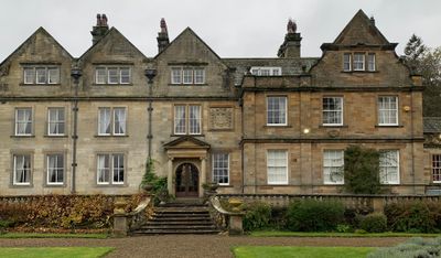
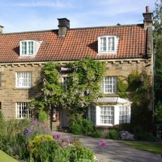
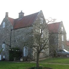
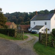
Egton Manor, Manor house in Egton, North Yorkshire, England.
Egton Manor is a stone-built house on a 6,000-acre estate in North Yorkshire with traditional architectural features and extensive gardens. Today the property operates as a venue for events and activities, serving multiple functions across its grounds.
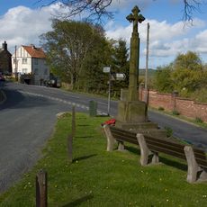
The estate appears in the Domesday Book and remained with the Fossard family until the Fosters acquired it in 1869. This change of ownership marked the start of a new chapter when the new family began reshaping the place and surrounding area.
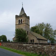
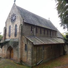
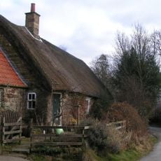
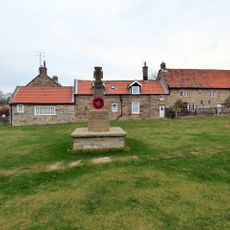
The Foster family shaped the village through building St. Hilda's Church and founding schools that still define community life today. This connection to local people remains visible in the architecture and buildings scattered across the area.
The property is available for visitors participating in organized events and activities that take place regularly throughout the year. The large grounds and gardens are part of the experience and should be considered when planning your visit.
The building underwent major changes in 1979 with parts demolished, yet it retained its protected status from 1952. This unusual transformation shows how the property adapted to new uses while keeping its historical designation.
Location: Egton
GPS coordinates: 54.43565,-0.76039
Latest update: December 14, 2025 12:23
Birch Hall Inn
3.4 km
Church of St Hilda
775 m
Wheatsheaf Inn
1.4 km
Church of St Thomas
3.1 km
Church of St Matthew and Churchyard Gateway
2.4 km
Beggar's Bridge
2.1 km
Ye Horseshoe Inn
1.4 km
Memorial cross for Probationary Flight Officer Francis Titcomb (the Swinsty Cross)
1.9 km
The Horse Shoe Hotel
388 m
Glaisdale War Memorial
3 km
Grosmont Bridge
1.9 km
North York Moors Railway Tunnel Approximately 130 Metres Long
2.3 km
Delves Cottage
1.5 km
North York Moors Railway Bridge Across The Murk Esk
2.3 km
Newbiggin Hall
4 km
Brereton Corner
4.7 km
Beckside Farmhouse And Attached Outbuilding
905 m
Waymarker
3.7 km
North York Moors Railway Footbridge Across The Murk Esk
2.3 km
Waymarker
1.9 km
Waymarker
2.7 km
Waymarker
1.9 km
Waymarker
4.1 km
Grosmont Station And Attached Yard Wall
2.3 km
Lady Cross wayside cross, north of the A171 and 20m west of the Barnby turn-off
3.3 km
North York Moors Railway Pedestrian Subway Approximately 110 Metres Long
2.3 km
Milestone, nr road to Hutton Mulgrave
3.2 km
Guidestone, Lady Cross, jct road to Hutton Mulgrave from the A171
3.3 kmVisited this place? Tap the stars to rate it and share your experience / photos with the community! Try now! You can cancel it anytime.
Discover hidden gems everywhere you go!
From secret cafés to breathtaking viewpoints, skip the crowded tourist spots and find places that match your style. Our app makes it easy with voice search, smart filtering, route optimization, and insider tips from travelers worldwide. Download now for the complete mobile experience.
A unique approach to discovering new places❞
— Le Figaro
All the places worth exploring❞
— France Info
A tailor-made excursion in just a few clicks❞
— 20 Minutes