Former Church of St Matthew, Grade II listed church building in Normanton, England
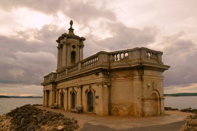
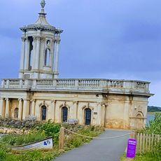
The Former Church of St Matthew rises from Rutland Water with classical architectural features including a Corinthian-style tower and a portico at its western entrance. The structure connects to the shoreline via a causeway, making it accessible on foot when water levels permit.
The building underwent reconstruction in 1826 under architect Thomas Cundy, transforming the medieval structure into a private chapel for the Earls of Ancaster family. This redesign gave the structure its current classical appearance during the 19th century.
The chapel serves as a venue for community events and musical performances, bringing visitors together at this water-surrounded location. The spaces preserve their original purpose while serving a wider audience today than a single family once did.
Access requires following a causeway connecting the building to the shoreline, which is passable during normal water conditions. Visitors should check weather conditions since heavy rainfall can raise water levels significantly.
The lower section was filled with stone and rubble with a concrete cap below window level to prevent flooding when reservoir waters rise. This protection allows the building to endure in its water-surrounded location indefinitely.
The community of curious travelers
AroundUs brings together thousands of curated places, local tips, and hidden gems, enriched daily by 60,000 contributors worldwide.