The Kings Arms Public House, Historic pub in York, England
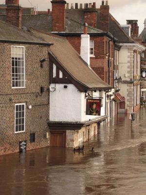
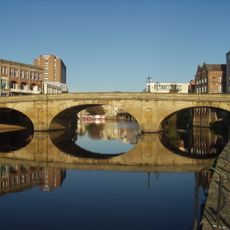
The Kings Arms is a historic pub beside the River Ouse in York with timber-framed upper floors and stone walls built from medieval materials. The building features outdoor seating along the river and displays flood level markers inside showing the height water has reached.
The building dates from the early 1600s and is the last remaining structure from First Water Lane, a medieval street cleared in 1852. When the city underwent changes that removed the entire street, this pub survived as a link to the past.
Samuel Smith's Brewery operates this establishment, maintaining long-standing British pub customs in the city. You can observe how locals gather here as part of their everyday social life.
The pub sits directly beside the river, so visitors should know the building faces regular flooding from water that sometimes rises high inside. The location right at the waterside makes it easy to find and access, and special flood gates help protect the space.
Despite experiencing flooding roughly four times per year, the Kings Arms operates without flood insurance for protection. This uncommon approach reveals how confident the pub is in its ability to weather the water and continue serving guests.
The community of curious travelers
AroundUs brings together thousands of curated places, local tips, and hidden gems, enriched daily by 60,000 contributors worldwide.