
Rustic Stone Bridge In Woods To South East Of Brasted Place
Rustic Stone Bridge In Woods To South East Of Brasted Place, bridge in Sundridge with Ide Hill, Sevenoaks, Kent, UK
Location: Sundridge with Ide Hill
GPS coordinates: 51.27446,0.11783
Latest update: November 25, 2023 00:30
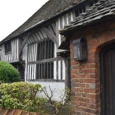
The Old Hall
438 m
Brasted Place And Saxon Cross
164 m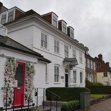
The White House
535 m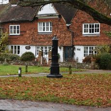
Pump In Middle Of Village Green
527 m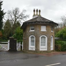
Combe Bank Lodge
417 m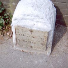
Milestone, Main Road, by No. 134, "Milestone", W of Social Club
595 m
Screen Wall With Entrance Gates To West Of Combe Bank Lodge
422 m
Section Of Stable Building With Clock Tower And Cupola To North West Of Brasted Place The Clock House
378 m
North Boundary Wall To Grounds Of Brasted Place
418 m
201 And 203, Main Road
467 m
199, Main Road
472 m
White Hart Cottages
474 m
K6 Telephone Kiosk
515 m
221 And 223, Main Road
407 m
Swaylands Cottage, The Green Swaylands, The Green
530 m
The Green
534 m
Spring Cottage
534 m
The Lodge And Entrance Gateway To Brasted Place
434 m
Rectory Lodge
541 m
The Green The Old Manor House, The Green
544 m
Mandeys South Down House
565 m
1-5, Rectory Lane
568 m
Dilgerts Eversley
570 m
Darenth Cottage
576 m
Markwick
587 m
The Red House
589 m
Stone Urns To South Of Brasted Place
159 m
Barton's Cottages Swan's
598 mReviews
Visited this place? Tap the stars to rate it and share your experience / photos with the community! Try now! You can cancel it anytime.
Discover hidden gems everywhere you go!
From secret cafés to breathtaking viewpoints, skip the crowded tourist spots and find places that match your style. Our app makes it easy with voice search, smart filtering, route optimization, and insider tips from travelers worldwide. Download now for the complete mobile experience.

A unique approach to discovering new places❞
— Le Figaro
All the places worth exploring❞
— France Info
A tailor-made excursion in just a few clicks❞
— 20 Minutes