221 And 223, Main Road, building in Sundridge with Ide Hill, Sevenoaks, Kent, UK
Location: Sundridge with Ide Hill
GPS coordinates: 51.27784,0.12006
Latest update: November 20, 2025 18:15
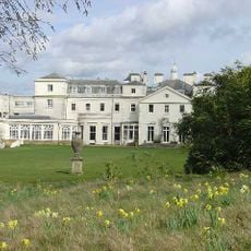
Combe Bank
439 m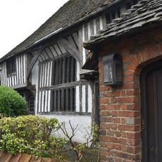
The Old Hall
58 m
Brasted Place And Saxon Cross
442 m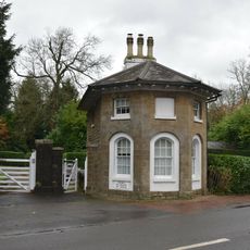
Combe Bank Lodge
465 m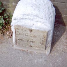
Milestone, Main Road, by No. 134, "Milestone", W of Social Club
286 m
Spring Cottage
224 m
Westernmost Of A Pair Of Sphinxes To West Of Combe Bank
465 m
Easternmost Of A Pair Of Sphinxes To West Of Combe Bank
452 m
Rustic Stone Bridge In Woods To South East Of Brasted Place
407 m
Wall Along Combe Bank Drive
406 m
Rustic Arch And Bridge
438 m
Urn To South West Of Combe Bank
397 m
Northernmost Urn To West Of Combe Bank
391 m
Southernmost Urn To West Of Combe Bank
381 m
Southernmost Urn To East Of Combe Bank
458 m
Statue of Lion to West of Combe Bank
450 m
Urn To South East Of Combe Bank
417 m
Ice House Adjoining Palm House To South East
427 m
135 And 137, Main Road
367 m
201 And 203, Main Road
115 m
199, Main Road
123 m
Stone Urns To South Of Brasted Place
457 m
Screen Wall With Entrance Gates To West Of Combe Bank Lodge
476 m
Earn
396 m
Earn
406 m
Earn
399 m
Earn
462 m
Earn
473 mReviews
Visited this place? Tap the stars to rate it and share your experience / photos with the community! Try now! You can cancel it anytime.
Discover hidden gems everywhere you go!
From secret cafés to breathtaking viewpoints, skip the crowded tourist spots and find places that match your style. Our app makes it easy with voice search, smart filtering, route optimization, and insider tips from travelers worldwide. Download now for the complete mobile experience.

A unique approach to discovering new places❞
— Le Figaro
All the places worth exploring❞
— France Info
A tailor-made excursion in just a few clicks❞
— 20 Minutes