Coal Tax Post To South East Of Langley Bottom Farm

Log in to your account

AroundUs is a community-driven map of interesting places, built by curious explorers like you. It grows with every review, story, and photo you share.
Connect to save your favorite spots, contribute locations, and create personalized routes.
By continuing, you accept our Terms and Conditions and our Privacy Policy

Coal Tax Post To South East Of Langley Bottom Farm

Add to collection
Map
Suggest a change
Share

Coal Tax Post To South East Of Langley Bottom Farm, agricultural structure in Epsom and Ewell, Surrey, UK
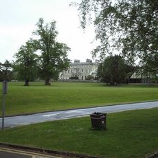
Location: Epsom and Ewell

GPS coordinates: 51.30094,-0.26718

Latest update: November 22, 2025 10:51

Around this place
Show the full map
Ashtead Park
United Kingdom

Ashtead Park

1.6 km
Warreners Cottage, Just North Of The Wall, Including Wall Running A Few Yards To North
United Kingdom

Warreners Cottage, Just North Of The Wall, Including Wall Running A Few Yards To North

625 m
The Well
United Kingdom

The Well

587 m
Coal Tax Post To North Of Racecourse
United Kingdom

Coal Tax Post To North Of Racecourse

1.3 km
Hurst Farm House
United Kingdom

Hurst Farm House

1.3 km
Dovecote 10 yards west of Hurst Farm House
United Kingdom

Dovecote 10 yards west of Hurst Farm House

1.2 km
Walls And Balustrades To Terraced Garden On North Side Of Ashtead Park House
United Kingdom

Walls And Balustrades To Terraced Garden On North Side Of Ashtead Park House

1.6 km
Sundial In Centre Of Forecourt In Front Of South Front Of Ashtead Park House
United Kingdom

Sundial In Centre Of Forecourt In Front Of South Front Of Ashtead Park House

1.6 km
102, Beaconsfield Road
United Kingdom

102, Beaconsfield Road

684 m
Coal Tax Post At Tq 200 579
United Kingdom

Coal Tax Post At Tq 200 579

1.1 km
Ashtead Park House And Attached Balustrades
United Kingdom

Ashtead Park House And Attached Balustrades

1.6 km
Iron Age banjo enclosure, associated enclosure and linear features, 323m south-west of South Tadworth Farm
United Kingdom

Iron Age banjo enclosure, associated enclosure and linear features, 323m south-west of South Tadworth Farm

1.6 km
Wall Bordering North West And South Sides Of The Warren
United Kingdom

Wall Bordering North West And South Sides Of The Warren

336 m
Wall Along East Part Of North Side Of The Warren Recreation Ground
United Kingdom

Wall Along East Part Of North Side Of The Warren Recreation Ground

674 m
Boundary Wall To Woodcote Park Extending From Opposite Pumping Station To Corner With Chalk Pit Road
United Kingdom

Boundary Wall To Woodcote Park Extending From Opposite Pumping Station To Corner With Chalk Pit Road

638 m
Boundary Wall To Woodcote Park To North East Of Land Occupied By Spindles
United Kingdom

Boundary Wall To Woodcote Park To North East Of Land Occupied By Spindles

1 km
Boundary Walls To Greenside And Flanking Sections Of Boundary Wall To Woodcote Park
United Kingdom

Boundary Walls To Greenside And Flanking Sections Of Boundary Wall To Woodcote Park

1.2 km
Coal Tax Post To South East End
United Kingdom

Coal Tax Post To South East End

721 m
Coal Tax Post 280 Yards North Of West End At Ngr Tq 22325709
United Kingdom

Coal Tax Post 280 Yards North Of West End At Ngr Tq 22325709

1.4 km
Coal Tax Post Near Junction With Headley Road
United Kingdom

Coal Tax Post Near Junction With Headley Road

1.5 km
Coal Tax Post At Junction With Langley Vale Road
United Kingdom

Coal Tax Post At Junction With Langley Vale Road

819 m
Wellhouse At Woodcote Park
United Kingdom

Wellhouse At Woodcote Park

1.4 km
Balustrade Enclosing Forecourt In Front Of South Front Of Ashtead Park House
United Kingdom

Balustrade Enclosing Forecourt In Front Of South Front Of Ashtead Park House

1.5 km
Old Stables, Now Barn At Downs House
United Kingdom

Old Stables, Now Barn At Downs House

1 km
Hurst Farm
United Kingdom

Hurst Farm

1.3 km
Princes Stand
United Kingdom

Princes Stand

1.6 km
Regiment of Trees
United Kingdom

Regiment of Trees

594 m
Witness
United Kingdom

Witness

552 m
Show the full map

Reviews

Visited this place? Tap the stars to rate it and share your experience / photos with the community! Try now! You can cancel it anytime.

« Coal Tax Post To South East Of Langley Bottom Farm: agricultural structure in Epsom and Ewell, Surrey, UK » is provided by Around Us (aroundus.com). Images and texts are derived from Wikimedia project under a Creative Commons license. You are allowed to copy, distribute, and modify copies of this page, under the conditions set by the license, as long as this note is clearly visible.

Discover hidden gems everywhere you go!

From secret cafés to breathtaking viewpoints, skip the crowded tourist spots and find places that match your style. Our app makes it easy with voice search, smart filtering, route optimization, and insider tips from travelers worldwide. Download now for the complete mobile experience.

Around Us App Screenshot

A unique approach to discovering new places

Le Figaro

All the places worth exploring

France Info

A tailor-made excursion in just a few clicks

20 Minutes