Lloyd's Bank, bank building in Low Fell, Gateshead, Tyne and Wear, England, UK
Location: Gateshead
Accessibility: Accessibile in sedia a rotelle
GPS coordinates: 54.93662,-1.60000
Latest update: November 16, 2025 09:15
Underhill
596 m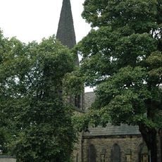
Church of St Helen
170 m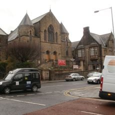
Wesley Memorial Methodist Church
233 m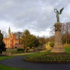
Gateshead Boer War Memorial
672 m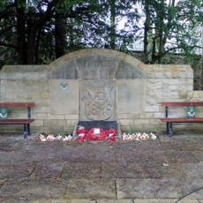
Durham Light Infantry Memorial, Saltwell Park
707 m
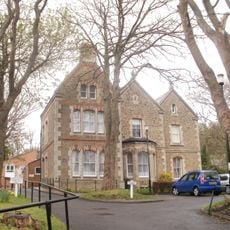
Home House
384 m
Thornlea (Part Of The Former Sherriff Hill Hall)
651 m
Walls, Gate Piers And Arches To Main Entrance Of Heathfield House And Stable Entrance To North
630 m
Former Joicey Road Open Air School
331 m
Stable Coach House To North Of Brackendene And North Gateway Link
450 m
Bellevue Lodge, Walls And Gate Piers
326 m
Winney House Hospital
249 m
South Africa War Memorial
14 m
Forecourt Walls And Gate Piers To Numbers 123 And 125
346 m
Fountain In Grounds To South West Of Whinney Hospital
243 m
Brackendene (North, South And West Houses)
454 m
Musgrave School
525 m
Knox's Buildings The Victoria Public House
583 m
Bellevue House
341 m
123 And 125, Kells Lane
355 m
Garden Wall To South West Of Number 231
397 m
Carter's Well Opposite Methodist Church Hall
240 m
Saltwell Park Museum
598 m
Heathfield House
617 m
Pavilion for Cultural Exchange
717 m
The Language Stone
679 m
Seedling
651 m
Work of art, sculpture
704 mReviews
Visited this place? Tap the stars to rate it and share your experience / photos with the community! Try now! You can cancel it anytime.
Discover hidden gems everywhere you go!
From secret cafés to breathtaking viewpoints, skip the crowded tourist spots and find places that match your style. Our app makes it easy with voice search, smart filtering, route optimization, and insider tips from travelers worldwide. Download now for the complete mobile experience.

A unique approach to discovering new places❞
— Le Figaro
All the places worth exploring❞
— France Info
A tailor-made excursion in just a few clicks❞
— 20 Minutes