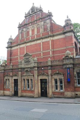
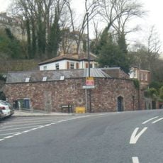
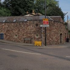
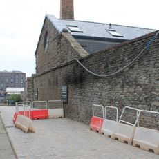
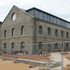
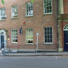
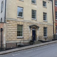
Hotwells Public Baths, Grade II listed public bath in Bristol, England.
Hotwells Public Baths is a Victorian brick building on Jacob's Wells Road featuring separate bathing areas for men and women arranged within its structure. The interior displays classical architectural details including high ceilings and decorative elements throughout the spaces.
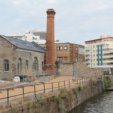
The baths opened in 1889 to address public health needs when most homes lacked private bathrooms and plumbing. It operated as a vital washing facility for residents for nearly a century before closing in the late 1970s.
The building now serves as the Bristol Community Dance Centre, hosting performances and classes that bring energy to the historic interior. The high ceilings and classical details create a distinctive setting for artistic work.
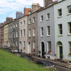
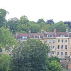
The building is Grade II listed and can be viewed from the outside to appreciate its brick architecture and classical design. It is located in a central area of Bristol and is easily walkable from nearby streets.
The facility tapped into natural hot springs from Jacob's Well, which were redirected in 1905 to add thermal qualities to the water. This natural heat source was a rare feature for bathing facilities of that era.
Location: City of Bristol
GPS coordinates: 51.45161,-2.60852
Latest update: December 13, 2025 17:04
SS Great Britain
269 m
Cabot Tower
291 m
Brandon Hill
291 m
Jacob's Well, Bristol
221 m
128 St George’s Road, the former women’s and children’s dispensary, known as The Read Dispensary
147 m
Bust of Samuel Plimsoll
156 m
16, 17 And 18, Queen's Parade
198 m
Bet tohorah at Jacob's Wells Road
206 m
Gas Lamp Post Approximately 20 Metres North Of Number 27
334 m
8-11, York Place
240 m
Gateway And Boundary Wall To East And West Sides Of Road
225 m
Retort House, Bristol
184 m
Former Engine House, Bristol
229 m
Gas Lamp Post Approximately 20 Metres North West Of Number 29
292 m
Premises Occupied By Wickham And Morris (timber Importers)
273 m
Albert Dock
316 m
St Brandon's House And Attached Front Area Railings
297 m
Retort House At St 5797 7251 East Of Gasferry Road
245 m
Stoneleigh House
342 m
Brandon House And Attached Wall And Doorway
303 m
1-14, Queen's Parade
279 m
Civil War earthworks on Brandon Hill
192 m
Attached Rubble Walls, Doorways And Garden Buildings To Clifton Hill House
346 m
Numbers 1 To 19 And Attached Front Basemant Area Railings
273 m
Number 27 And Attached Front Area Railings And Rear Garden Walls
337 m
Railings, Gates And Pier To Brandon Hill Across South West End Of Great George Street
240 m
Gas Lamp Post Approximately 10 Metres North East Of Gates To Church Of St George, Brandon Hill
243 m
Great Western Dry Dock
269 mVisited this place? Tap the stars to rate it and share your experience / photos with the community! Try now! You can cancel it anytime.
Discover hidden gems everywhere you go!
From secret cafés to breathtaking viewpoints, skip the crowded tourist spots and find places that match your style. Our app makes it easy with voice search, smart filtering, route optimization, and insider tips from travelers worldwide. Download now for the complete mobile experience.
A unique approach to discovering new places❞
— Le Figaro
All the places worth exploring❞
— France Info
A tailor-made excursion in just a few clicks❞
— 20 Minutes